Tuesday 19 March 2024 at 10:55
Volta Ciclista a Catalunya '24 / Stage 2
Mataró - Vallter
Classification: 2.UWT - Category ME
The stage
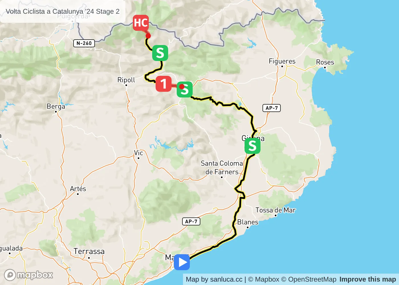
Stage 2 of the 2024 Volta Ciclista a Catalunya is a mountain stage that will take place on Tuesday 19 March 2024 at 10:55.The stage starts in Mataró and finishes in Vallter. Start time is 10:55 with an expected finish at 15:34 (average speed of 40 km/h).
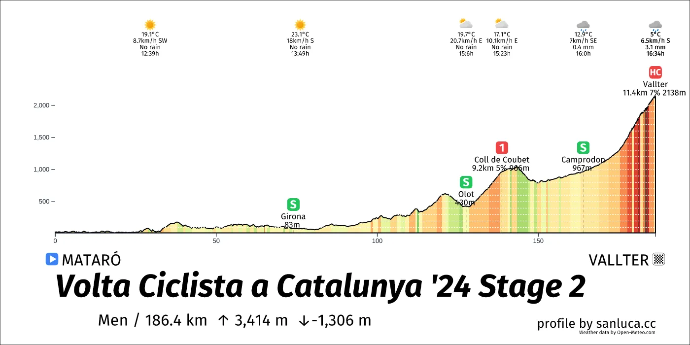
The total distance of the stage is 186.4 km. The stage includes 2 categorized climbs and 3 intermediate sprints. The stage has a total elevation gain of 3414.2 m with the highest altitude of the stage being 2146 m. The total descent of the stage is -1305.7 m.
Weather and forecast
- The race will have temperatures between 5 and 23°C, with an average of 18°C.
- 7 mm of rain expected at some point in the race
- The wind will come mainly from S, SW, SE, E, NE, W with an average of 13 km/h wind. The maximum wind speed will be 24 km/h with gusts of up to 44 km/h.
Points of interest
The stage includes 2 categorized climbs and 3 intermediate sprints.
Girona
Girona is a Sprint at 73.9 km (112.4 km to go).
Olot
Olot is a Sprint at 127.6 km (58.8 km to go).
Coll de Coubet
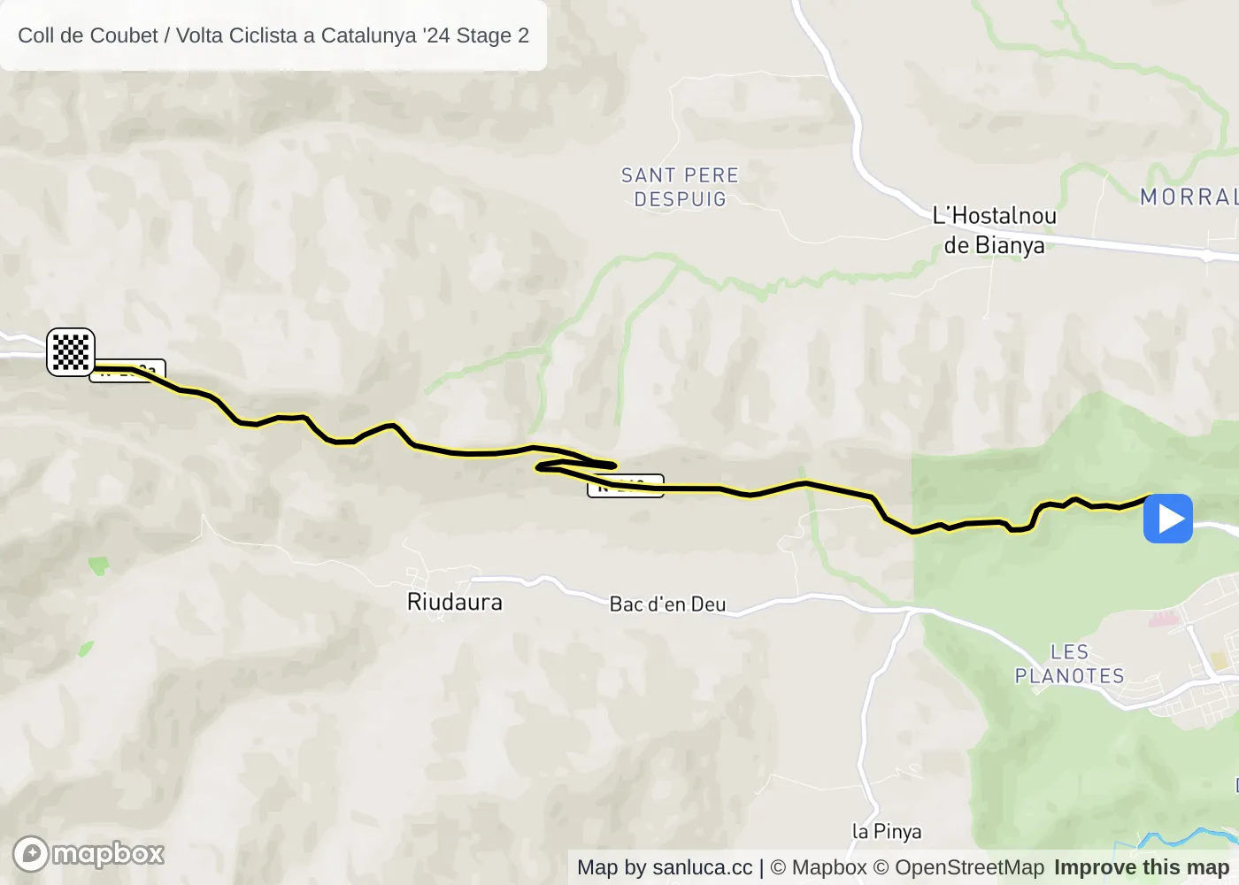
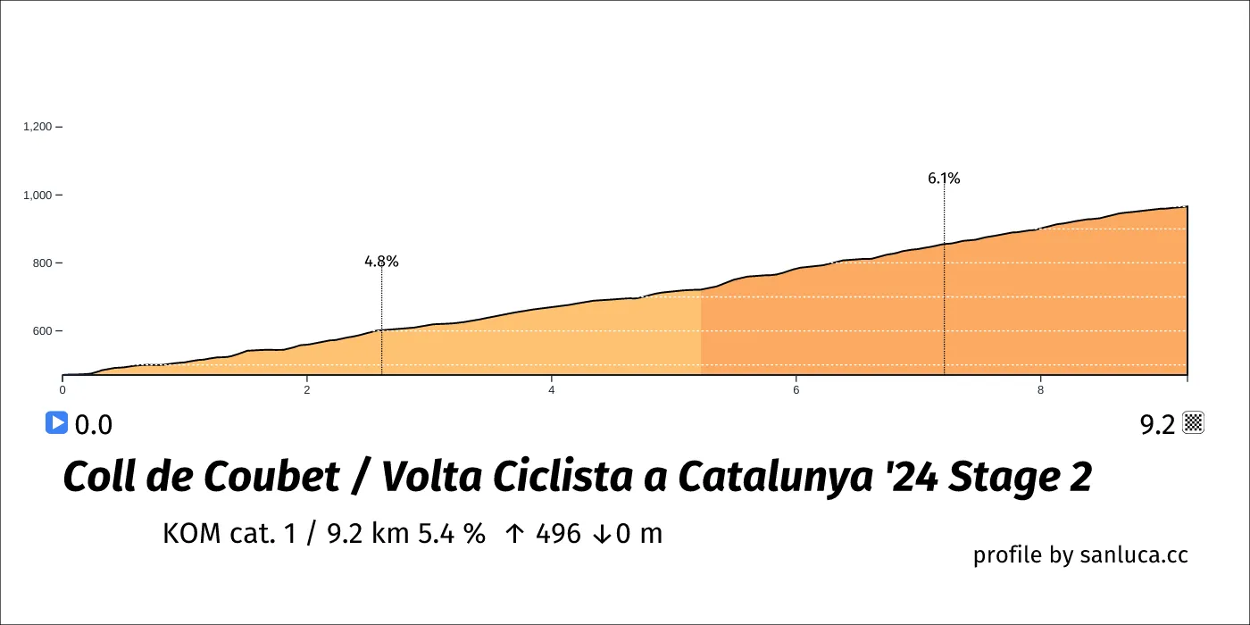
Coll de Coubet is a KOM cat. 1 climb, which starts at 129.5 km (56.9 km to go) and ends at 138.7 km (47.7 km to go). It has total distance of 9.2 km, and an average gradient of 5.4%, going from 470 to 966 meters of altitude.
Camprodon
Camprodon is a Sprint at 164 km (22.4 km to go).
Vallter
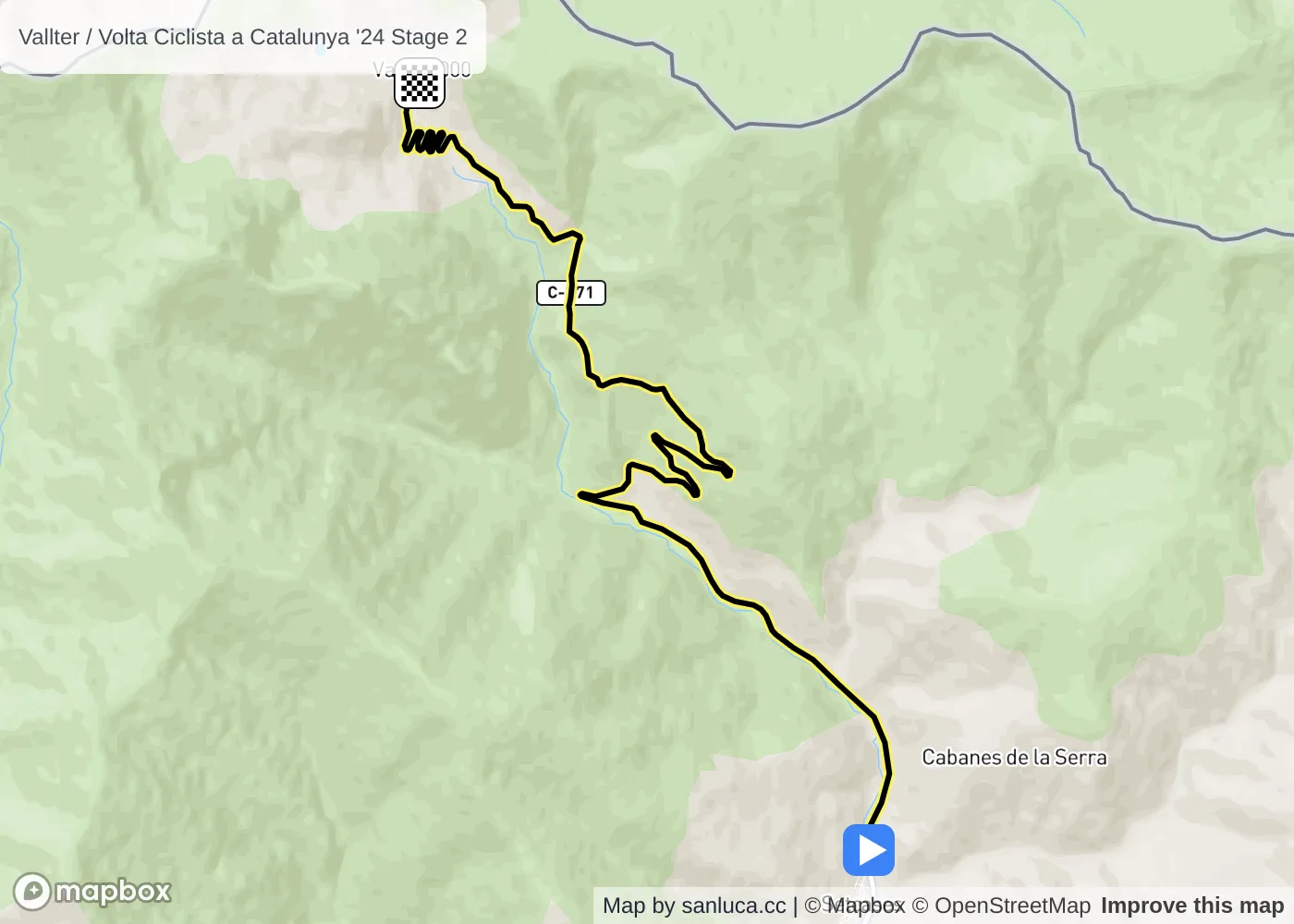
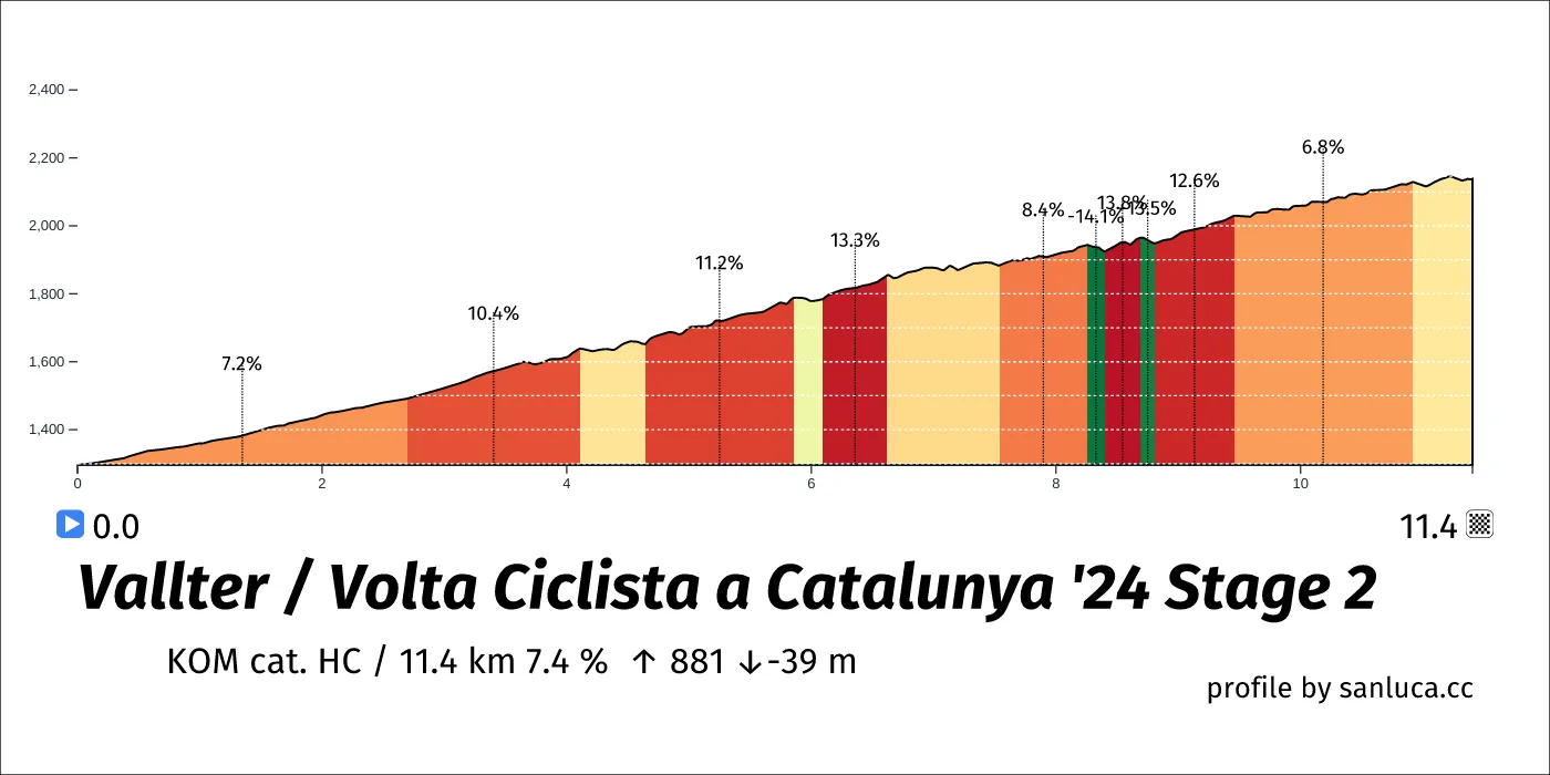
Vallter is a KOM cat. HC climb, which starts at 175 km (11.4 km to go) and ends at 186.4 km (0 km to go). It has total distance of 11.4 km, and an average gradient of 7.4%, going from 1296 to 2138 meters of altitude.
Final 3k
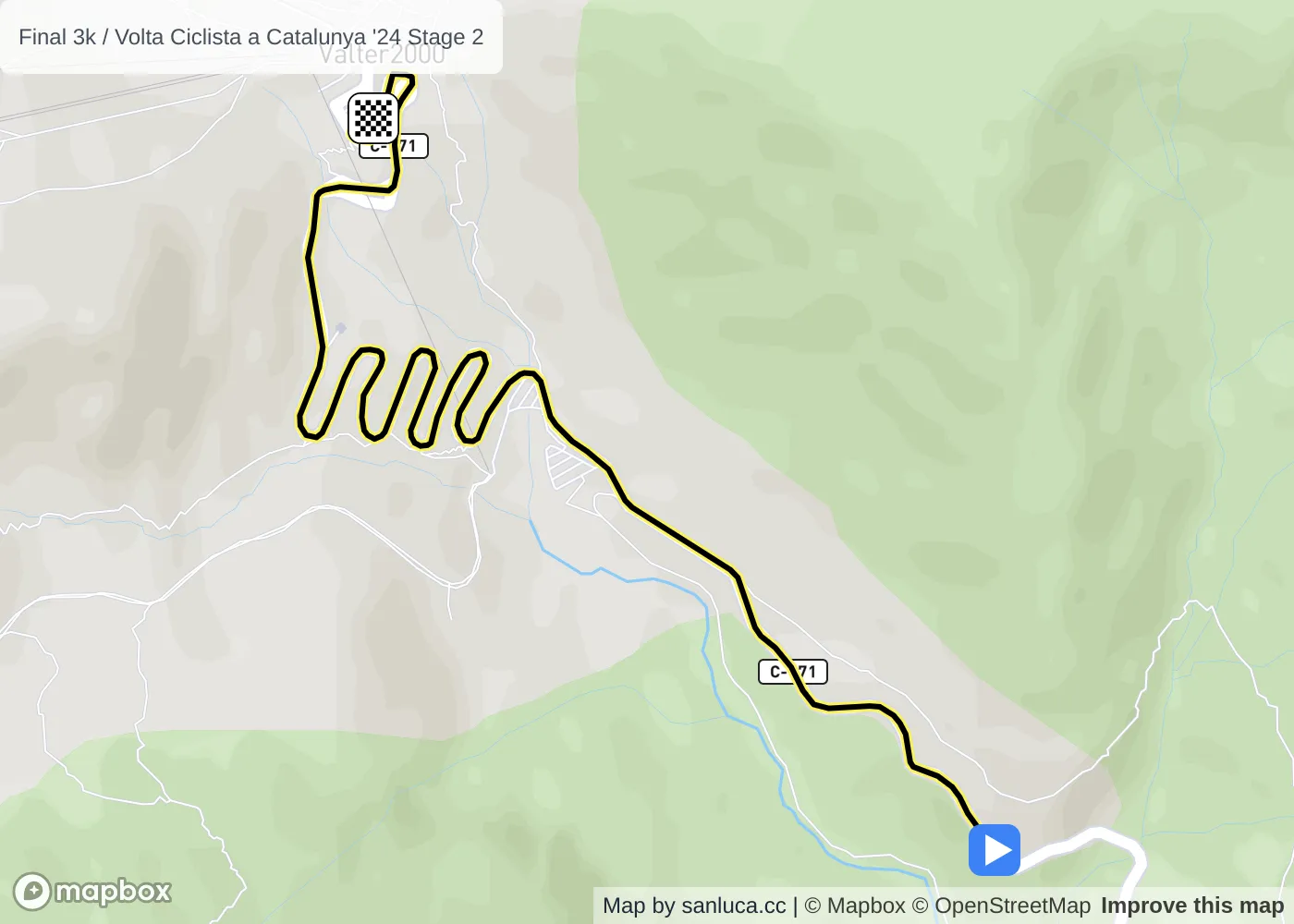
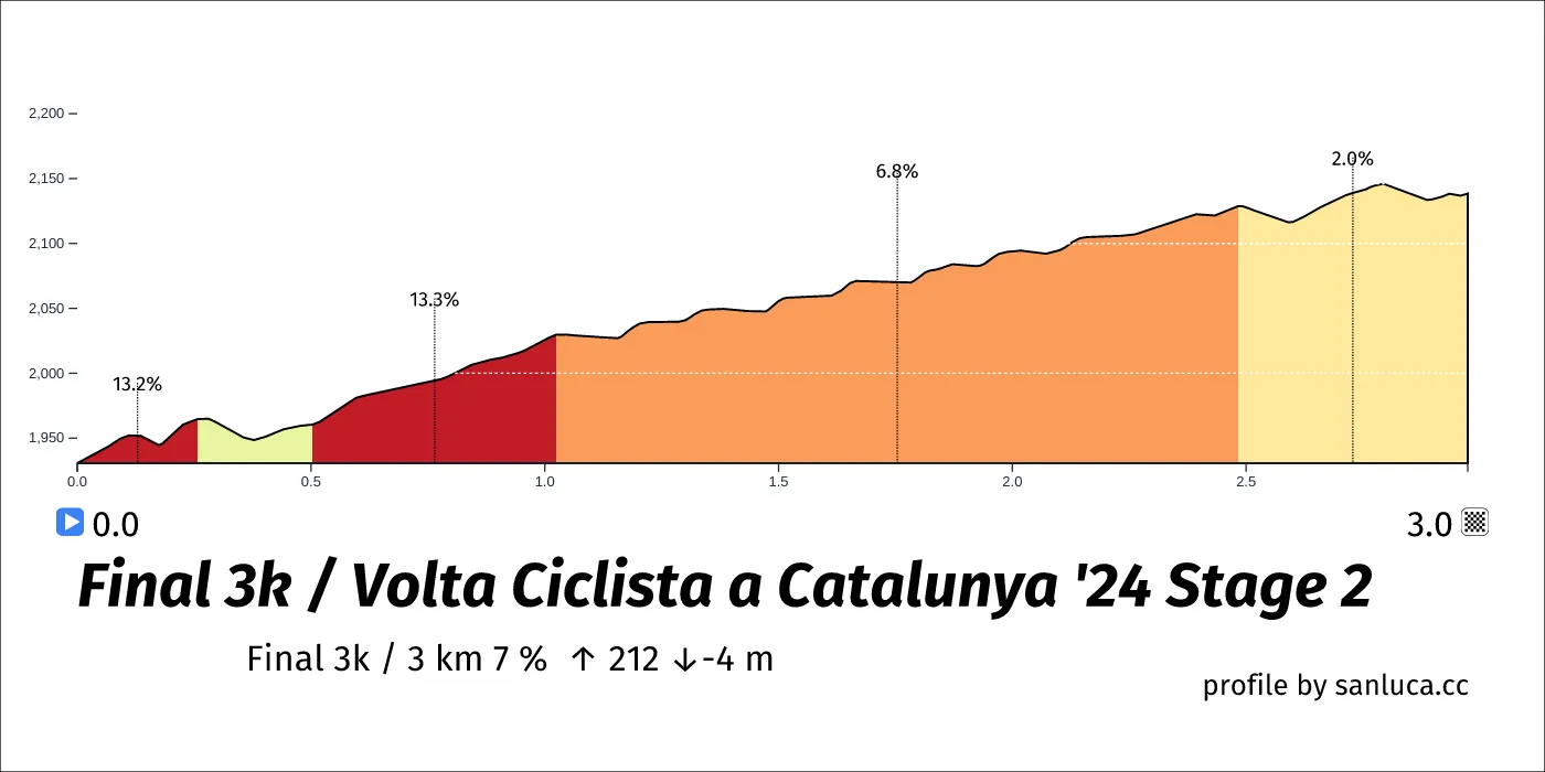
The final 3 km for this stage starts at 183.4 km, has an average gradient of 7%, and reaching 2138 m of altitude.
