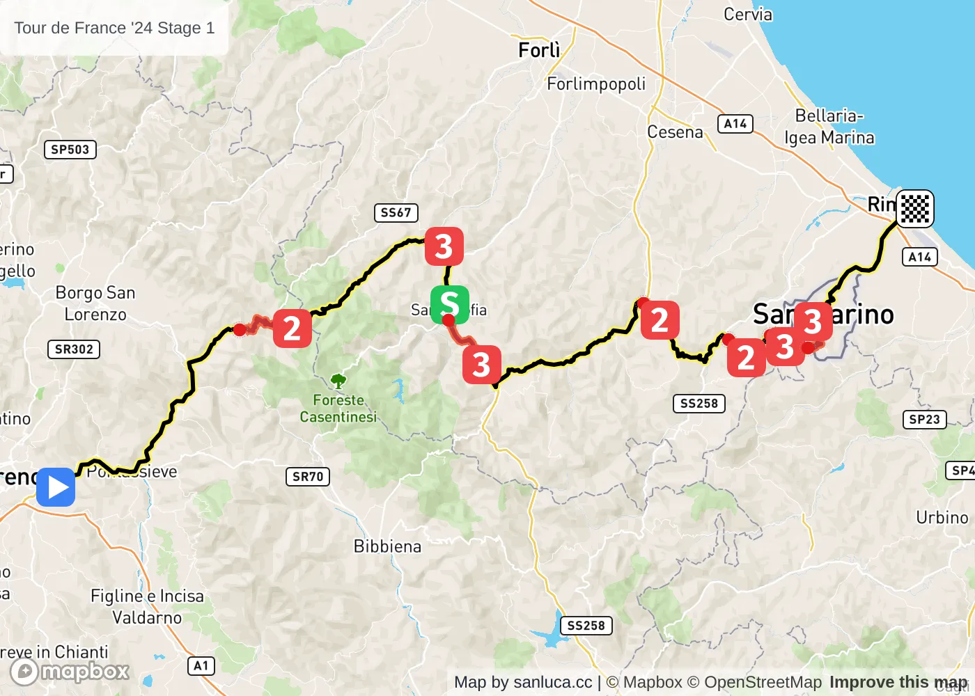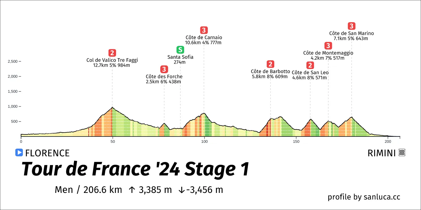
- Total distance: 206.6 km
- Type: Mountain
- Ascent: 3384.6 m
- Descent: -3456.2 m
- Date: Jun 29
- Start time: 10:40
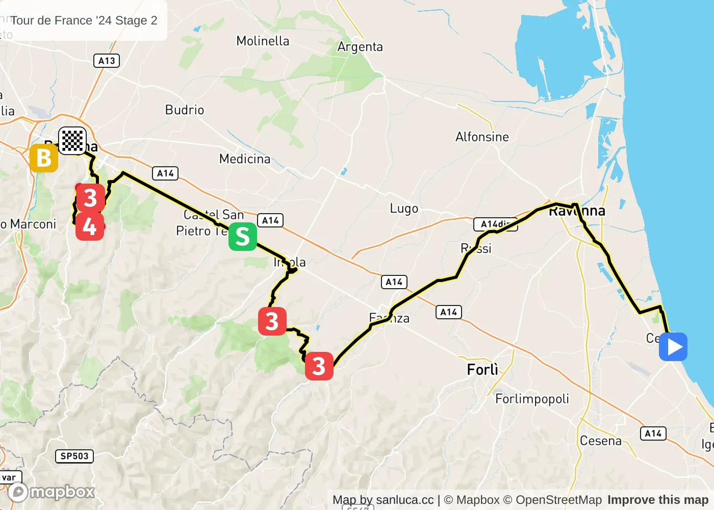
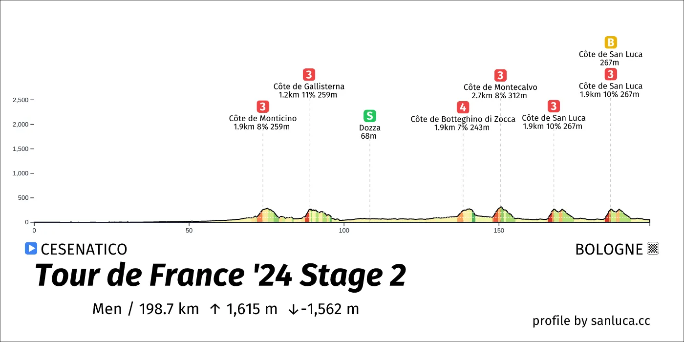
- Total distance: 198.7 km
- Type: Hilly
- Ascent: 1615.3 m
- Descent: -1561.5 m
- Date: Jun 30
- Start time: 10:35
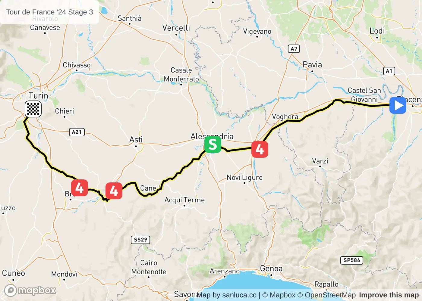
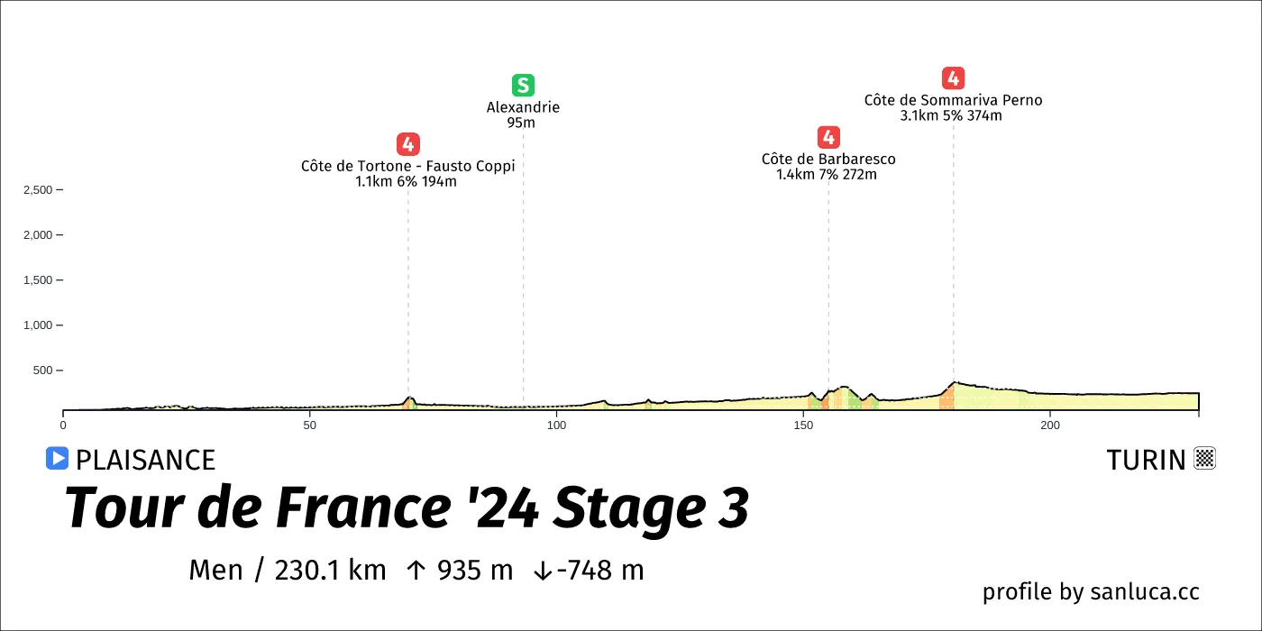
- Total distance: 230.1 km
- Type: Hilly
- Ascent: 935.1 m
- Descent: -747.8 m
- Date: Jul 1
- Start time: 09:35
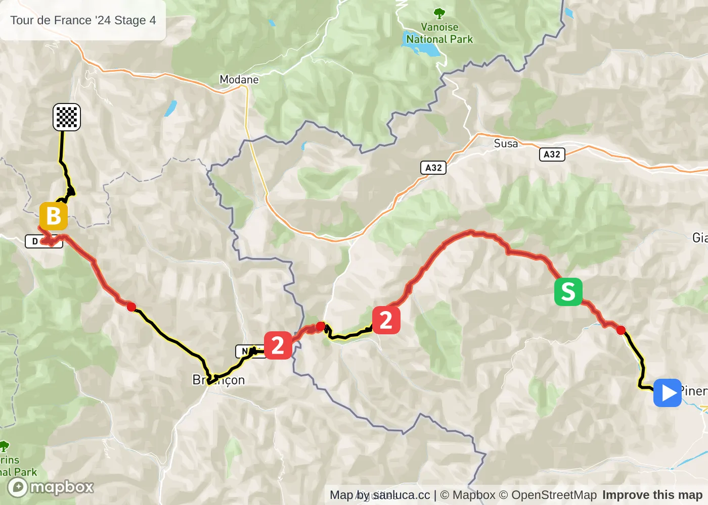
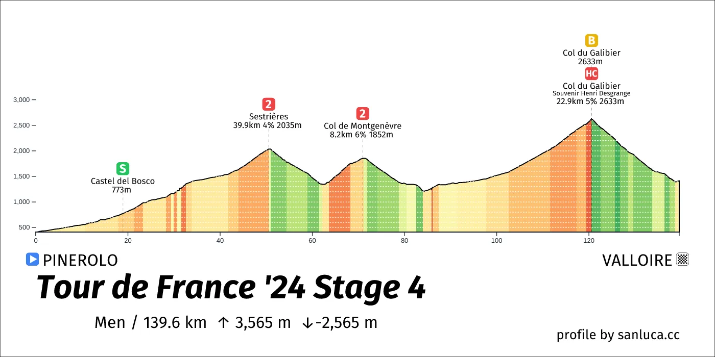
- Total distance: 139.6 km
- Type: Mountain
- Ascent: 3565.3 m
- Descent: -2564.6 m
- Date: Jul 2
- Start time: 11:15
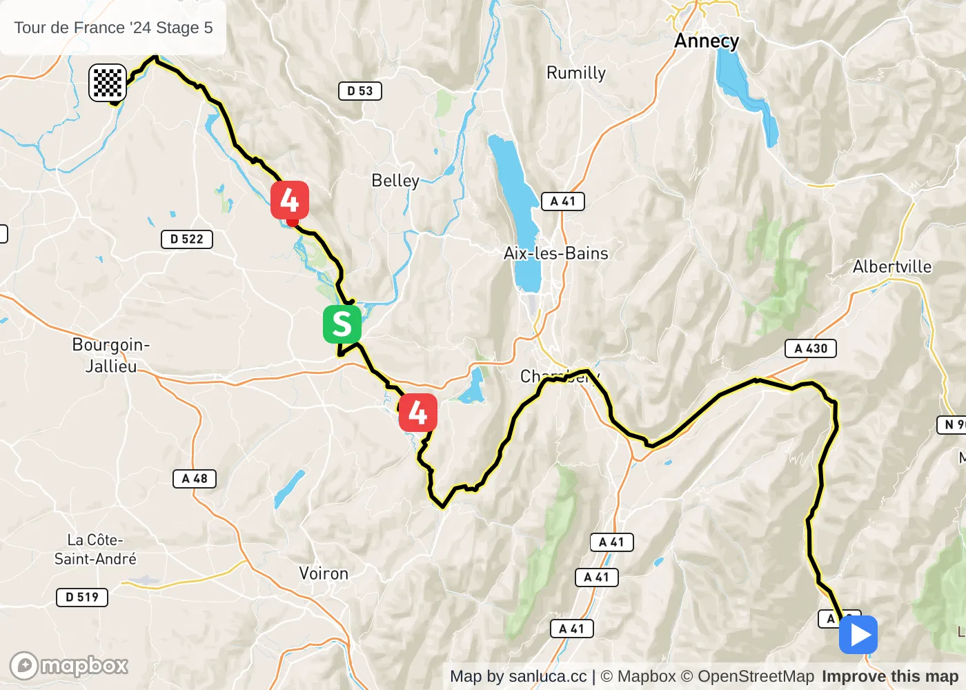
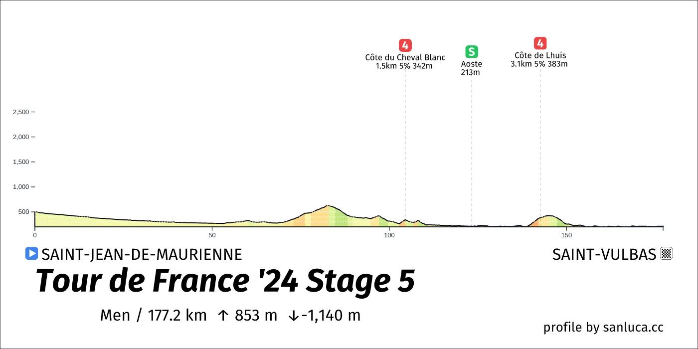
- Total distance: 177.2 km
- Type: Lumpy
- Ascent: 853.5 m
- Descent: -1139.9 m
- Date: Jul 3
- Start time: 11:30
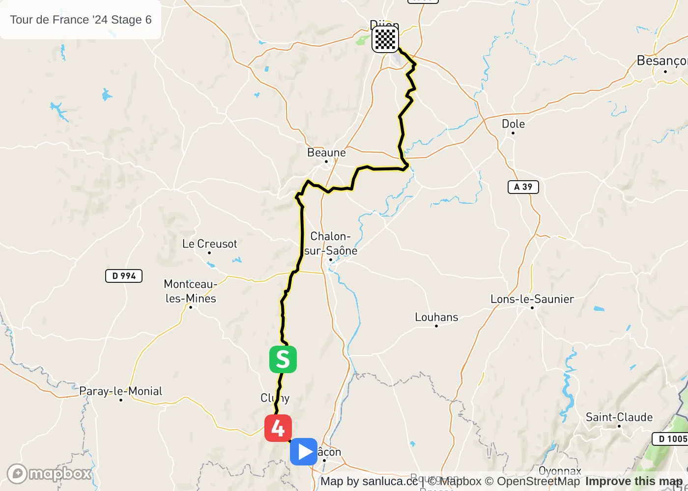
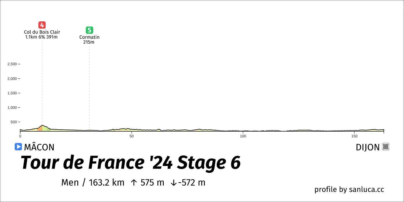
- Total distance: 163.2 km
- Type: Lumpy
- Ascent: 575 m
- Descent: -571.6 m
- Date: Jul 4
- Start time: 11:50
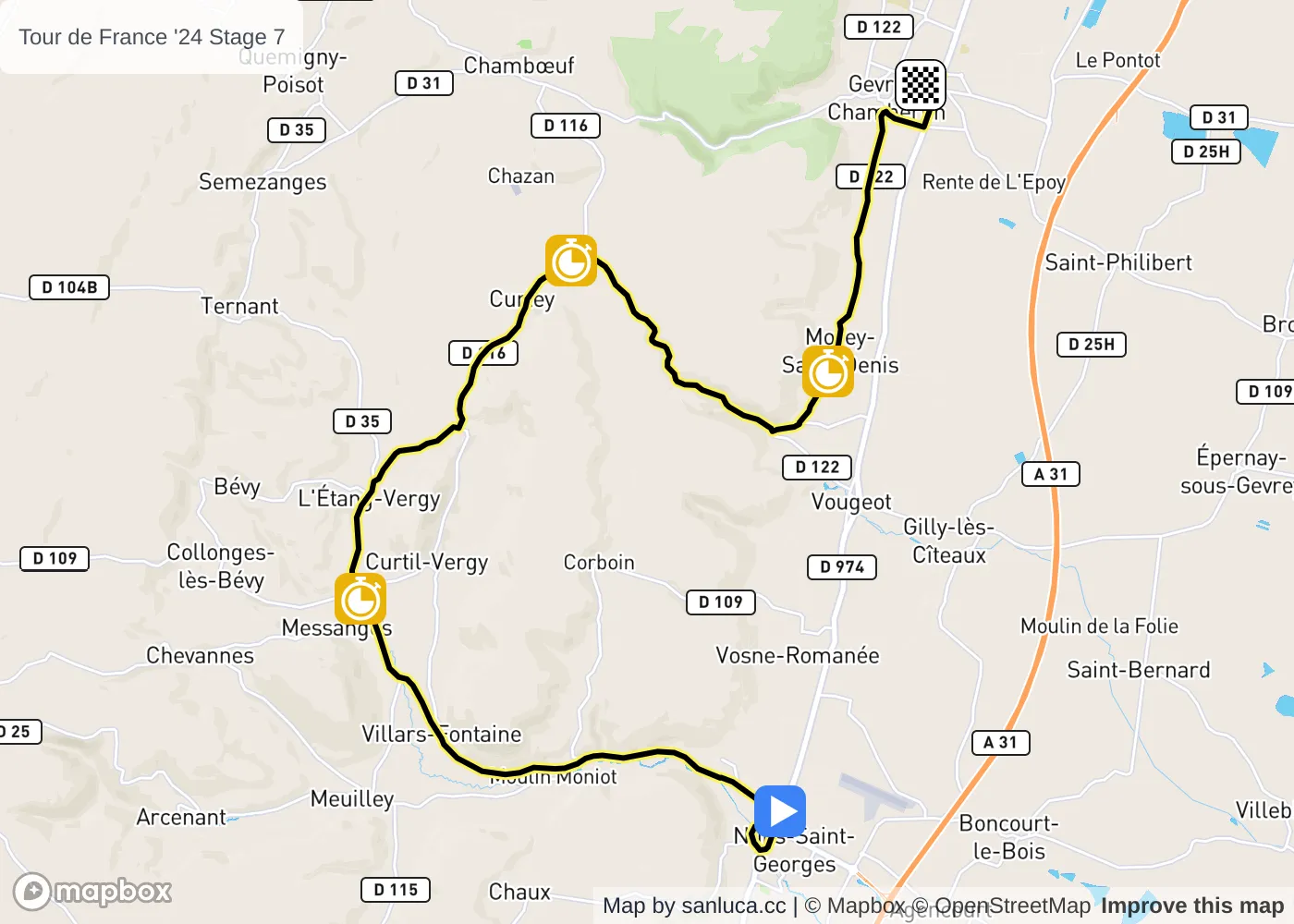
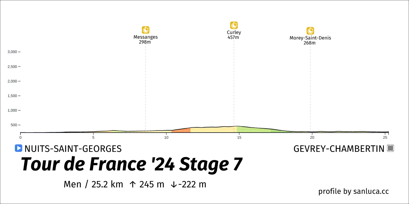
- Total distance: 25.2 km
- Type: Flat
- Ascent: 245 m
- Descent: -221.8 m
- Date: Jul 5
- Start time: 11:05
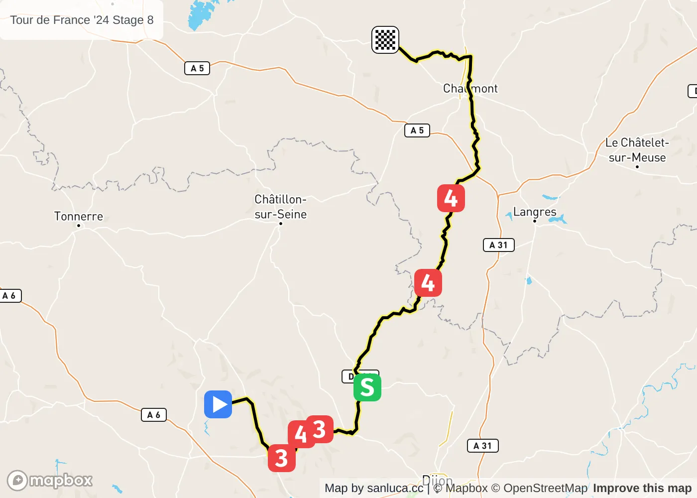
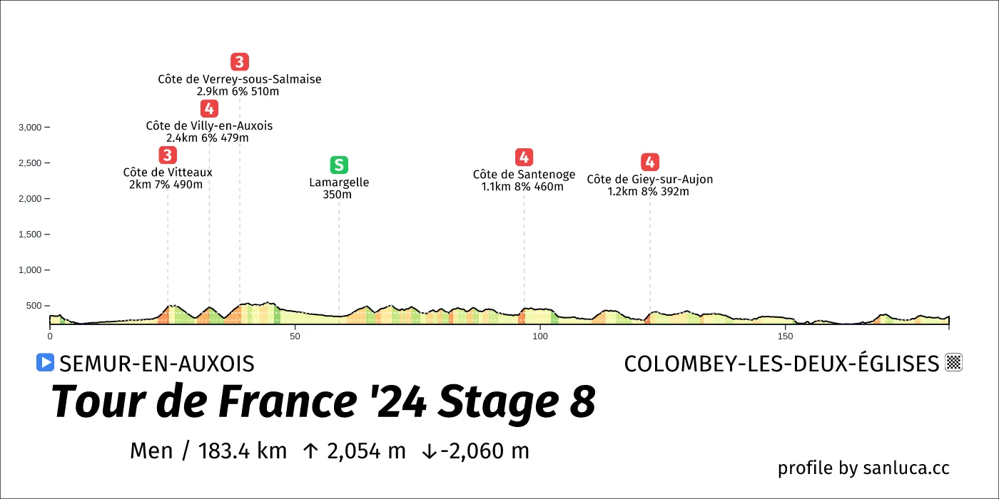
- Total distance: 183.4 km
- Type: Hilly
- Ascent: 2054.2 m
- Descent: -2060.4 m
- Date: Jul 6
- Start time: 11:20
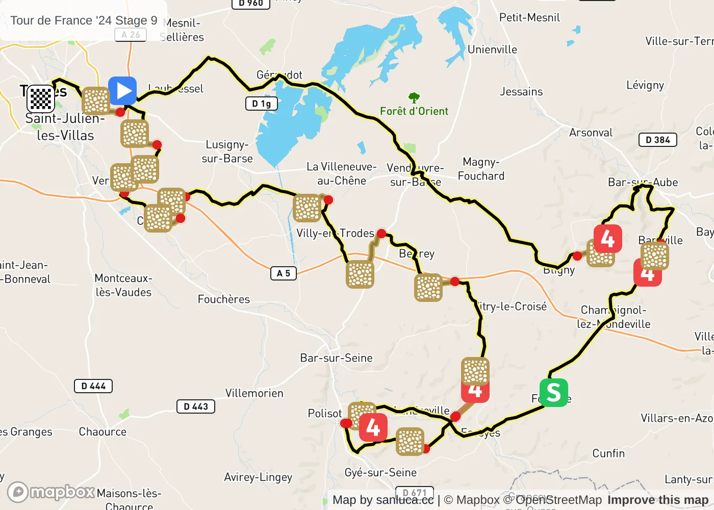
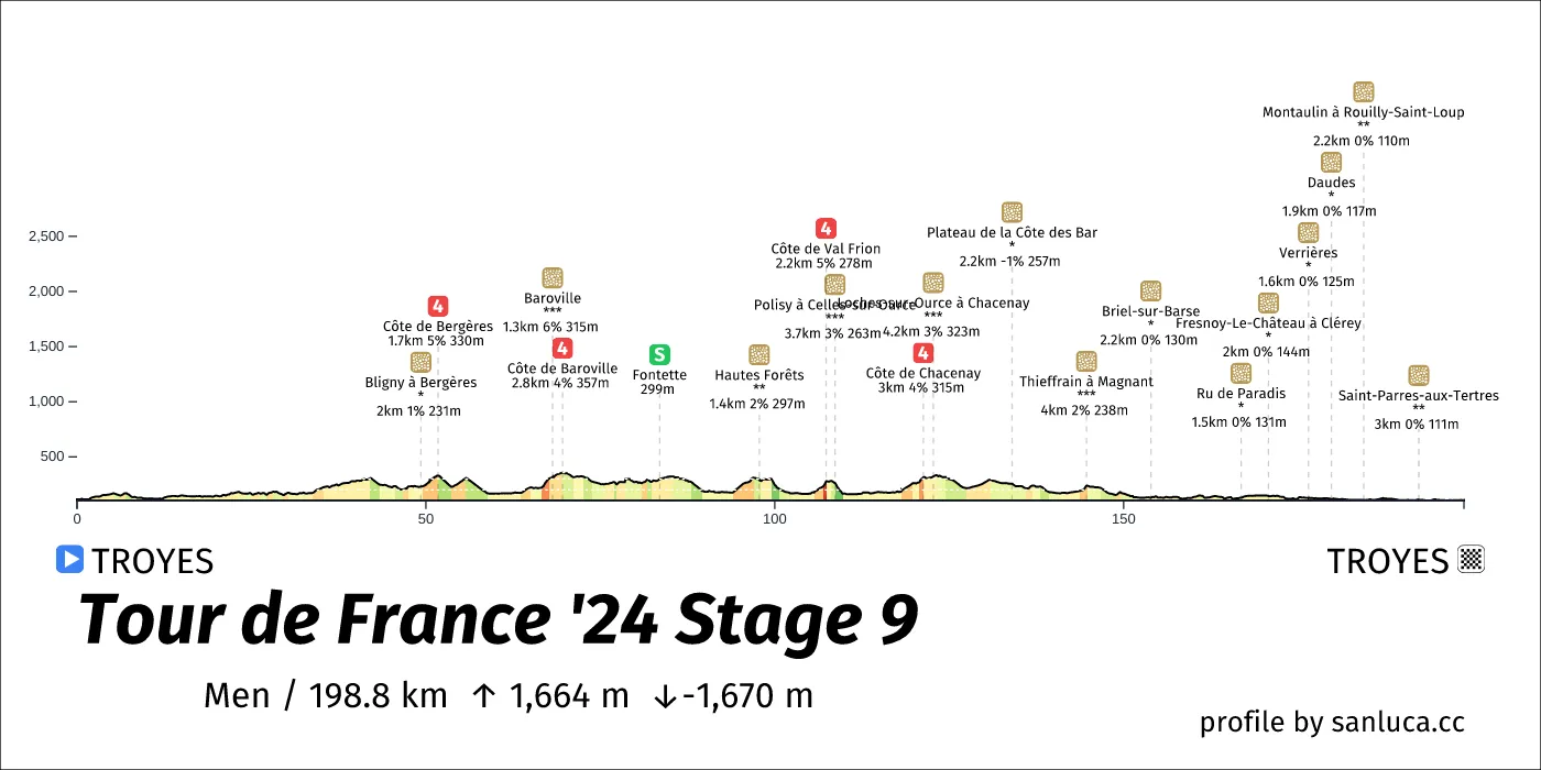
- Total distance: 198.8 km
- Type: Lumpy
- Ascent: 1663.8 m
- Descent: -1670.1 m
- Date: Jul 7
- Start time: 11:35
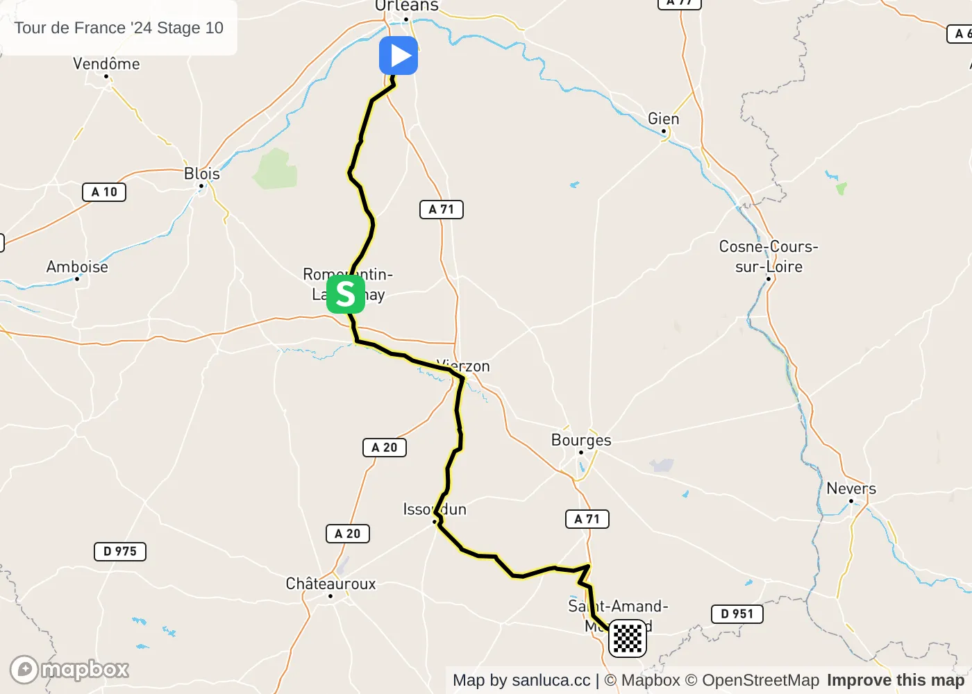
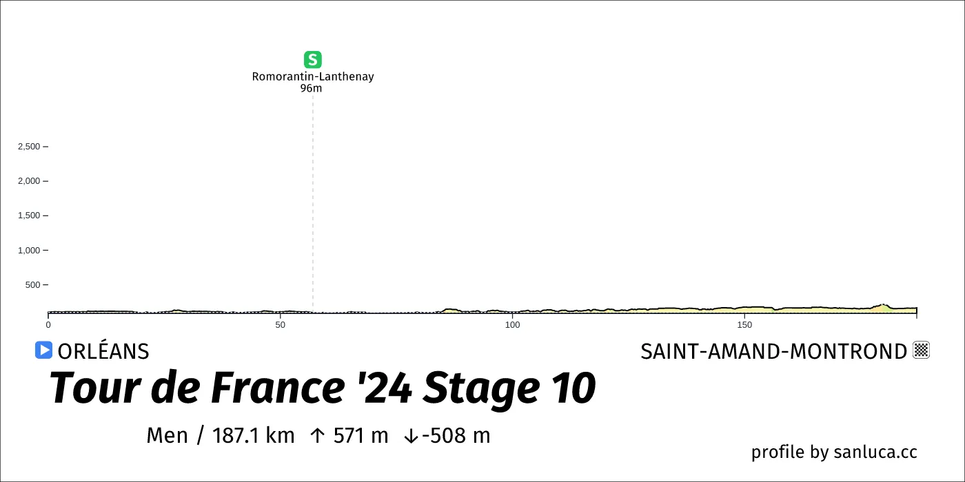
- Total distance: 187.1 km
- Type: Flat
- Ascent: 570.8 m
- Descent: -507.5 m
- Date: Jul 9
- Start time: 11:25
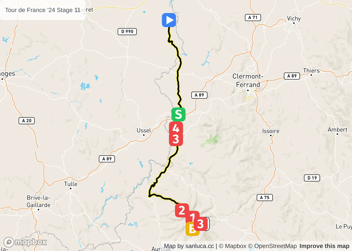
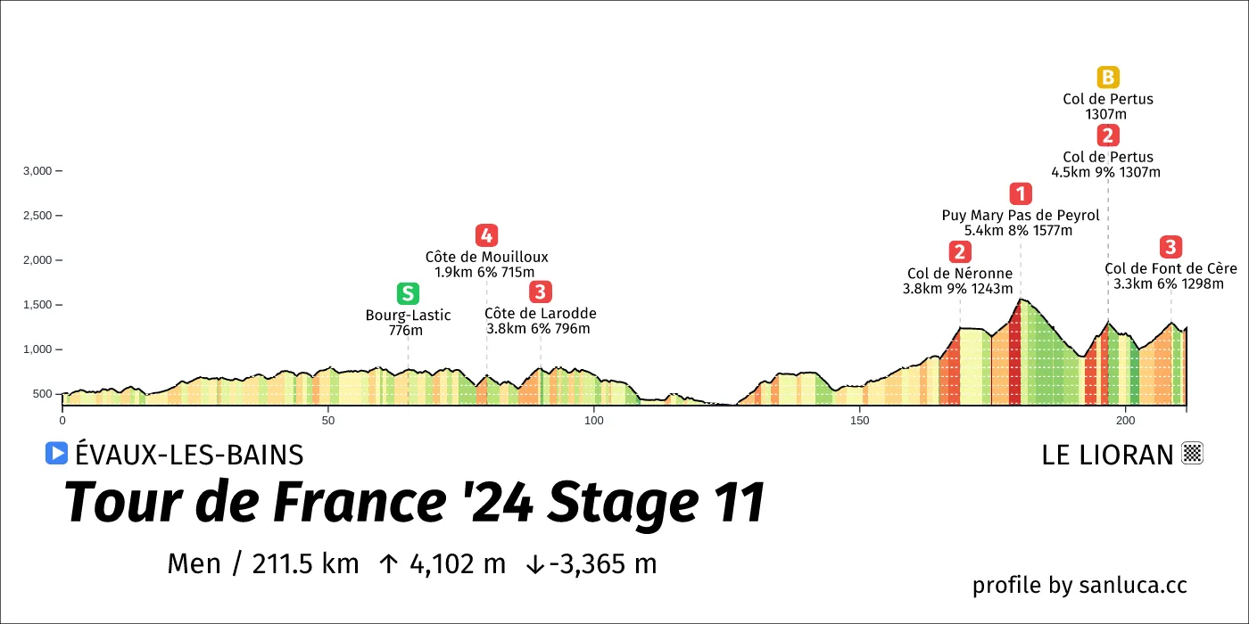
- Total distance: 211.5 km
- Type: Medium Mountain
- Ascent: 4101.9 m
- Descent: -3365.4 m
- Date: Jul 10
- Start time: 09:30
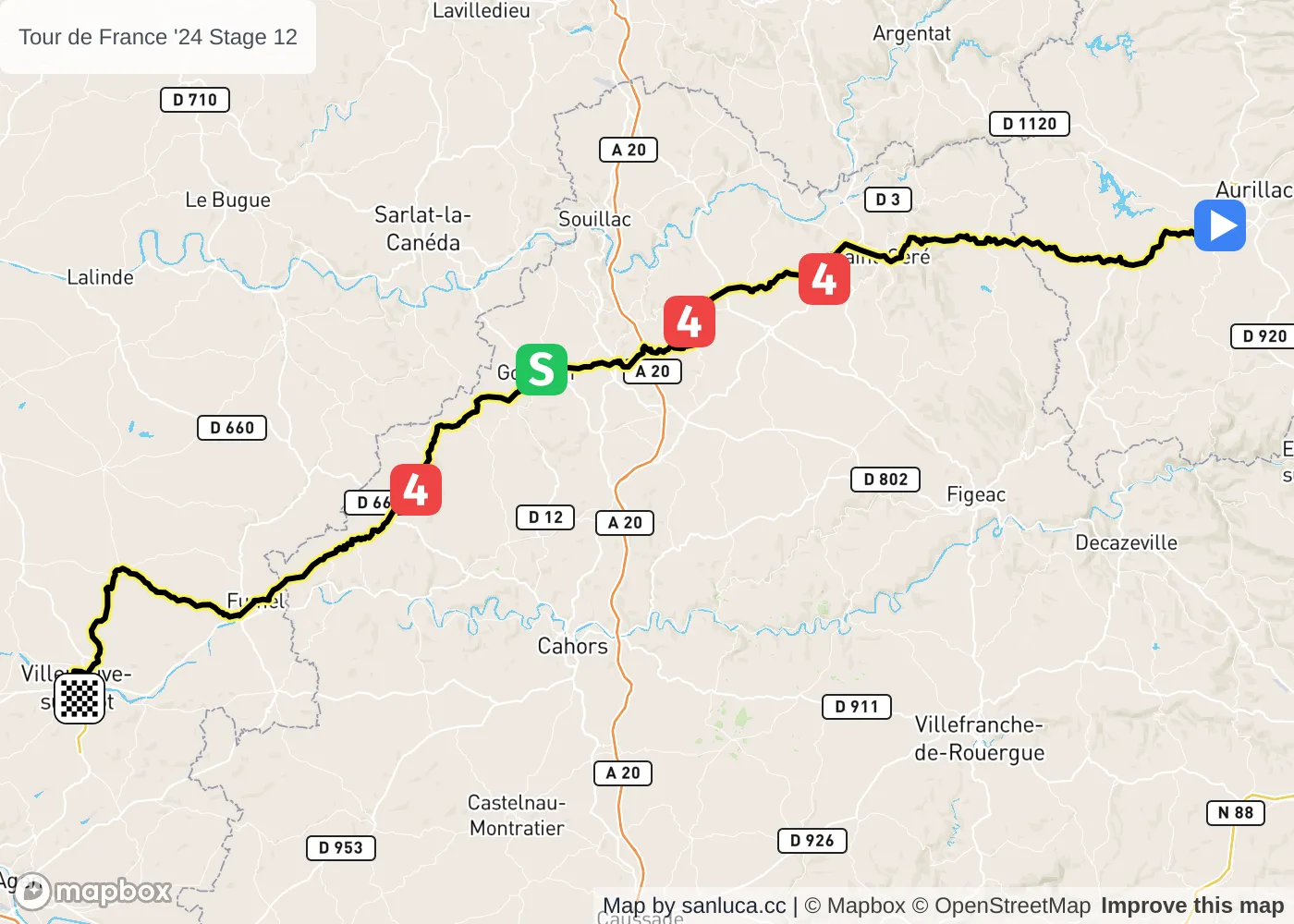
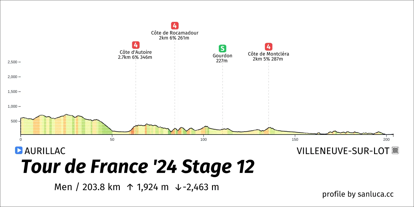
- Total distance: 203.8 km
- Type: Hilly
- Ascent: 1924.3 m
- Descent: -2462.9 m
- Date: Jul 11
- Start time: 10:50
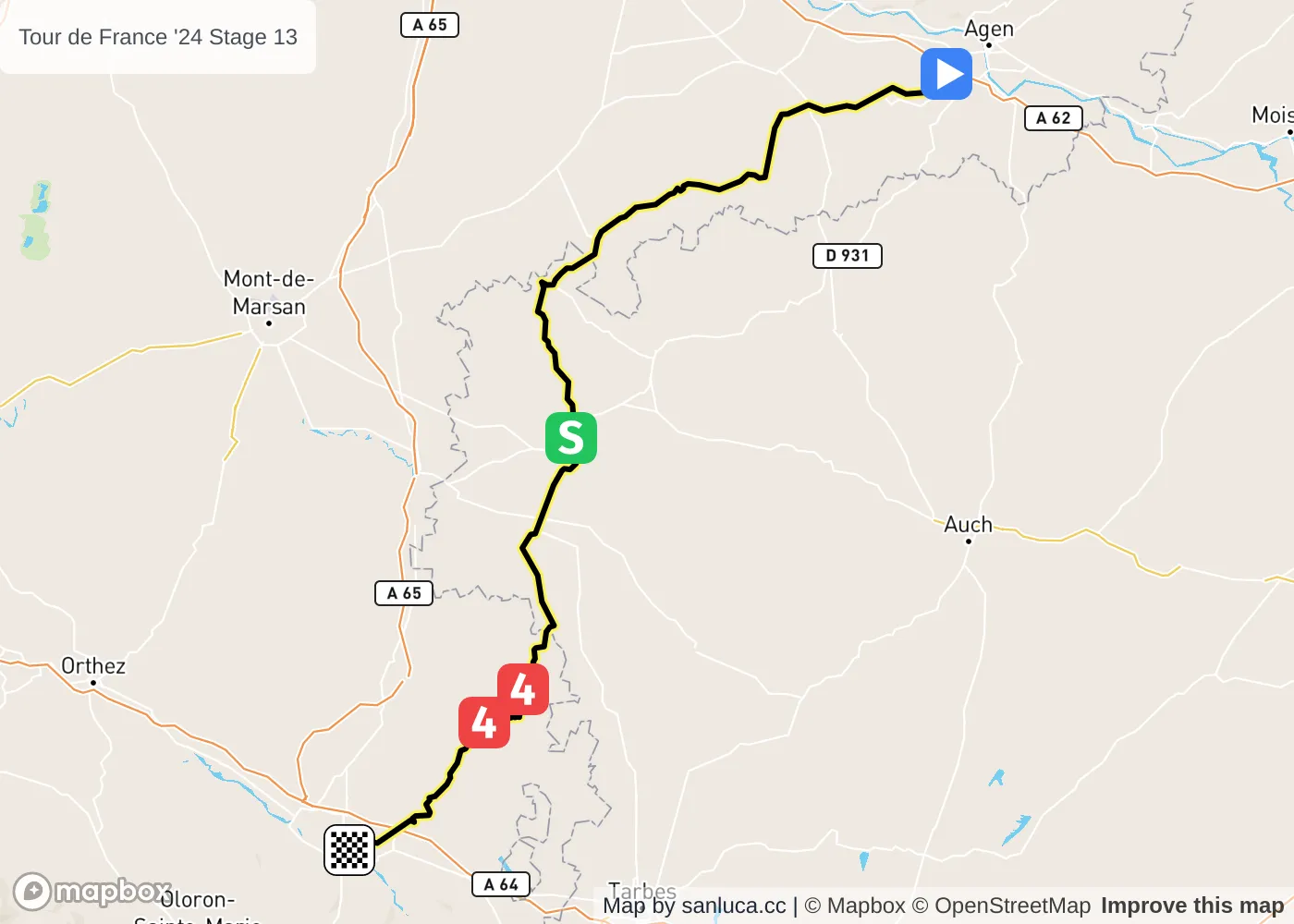
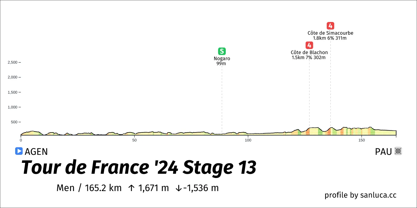
- Total distance: 165.2 km
- Type: Hilly
- Ascent: 1671.4 m
- Descent: -1535.9 m
- Date: Jul 12
- Start time: 11:50
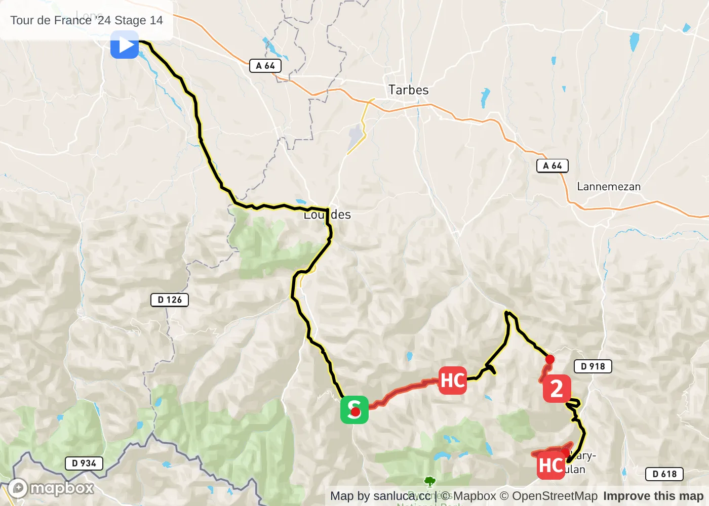
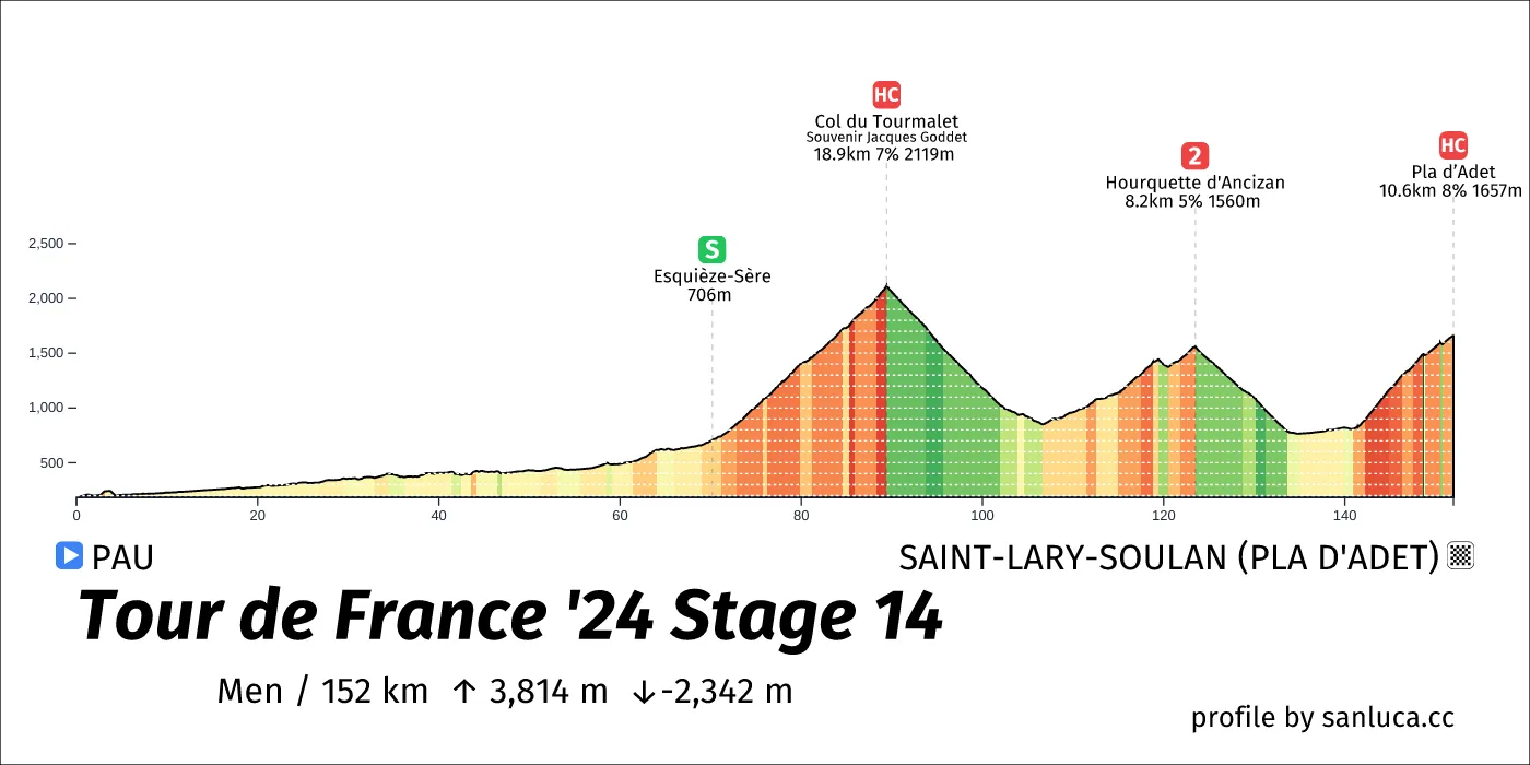
- Total distance: 152 km
- Type: Mountain
- Ascent: 3814.2 m
- Descent: -2342 m
- Date: Jul 13
- Start time: 11:20
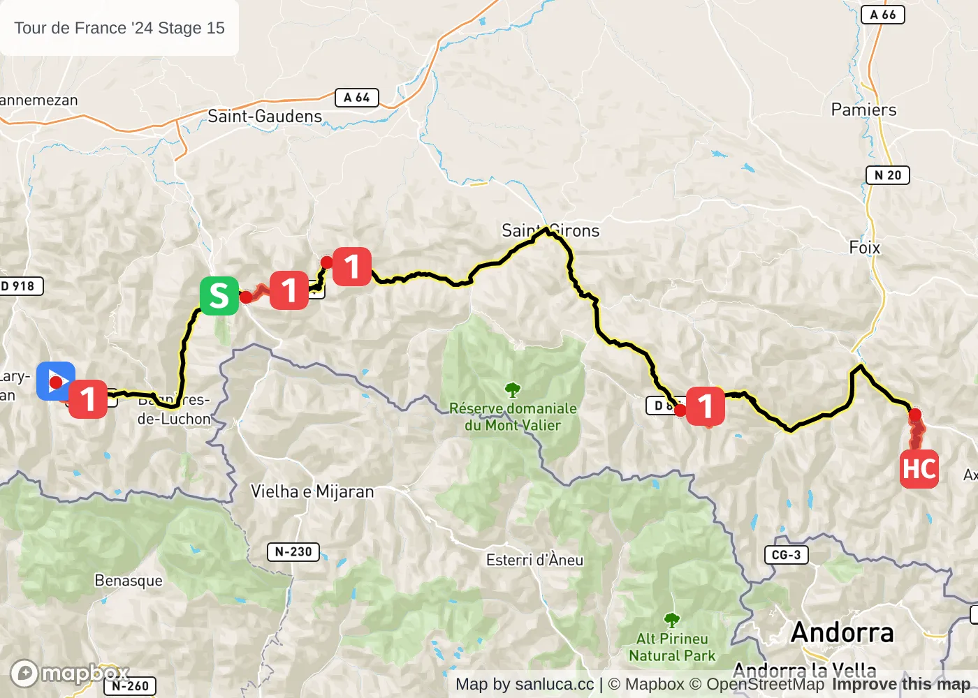
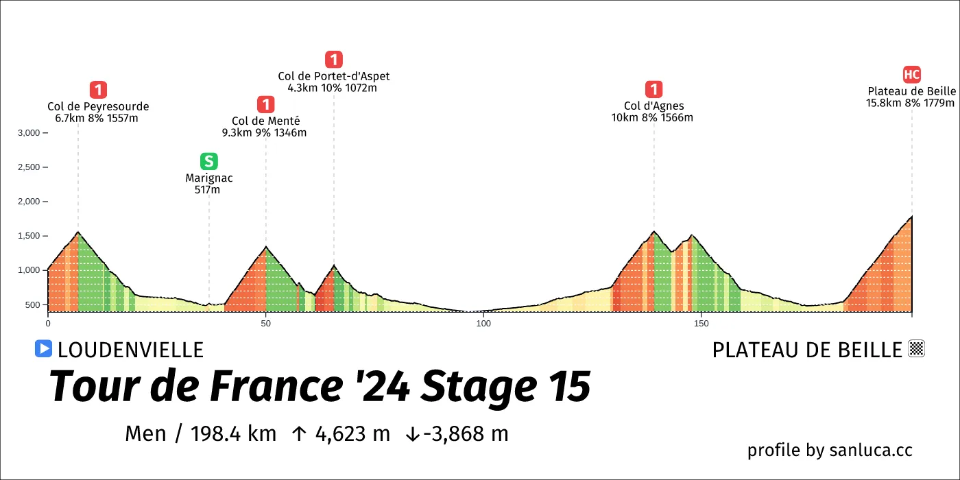
- Total distance: 198.4 km
- Type: Mountain
- Ascent: 4622.6 m
- Descent: -3867.6 m
- Date: Jul 14
- Start time: 10:05
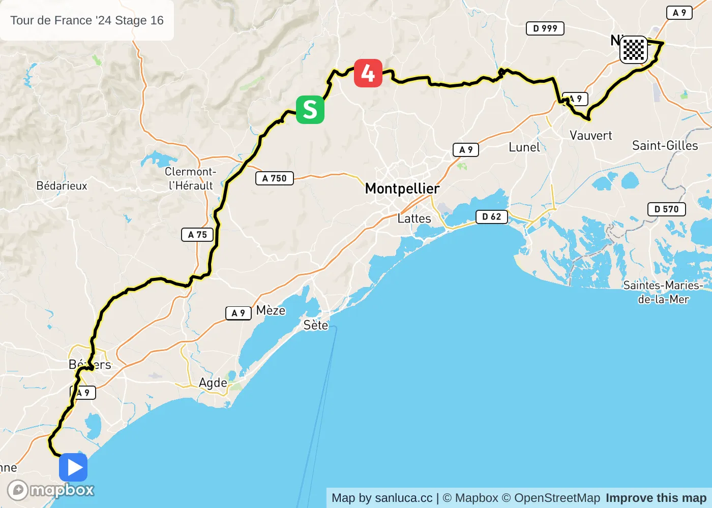
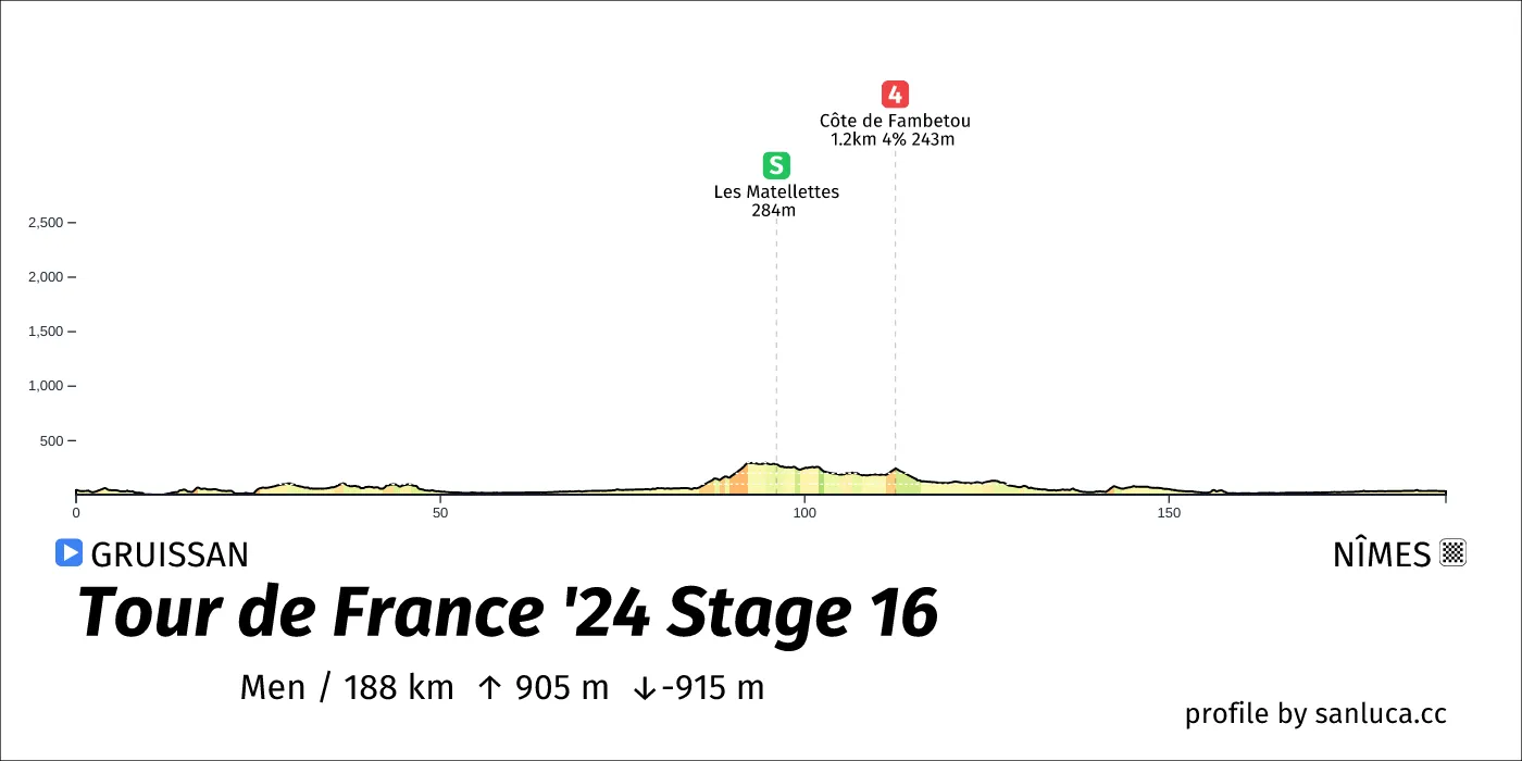
- Total distance: 188 km
- Type: Flat
- Ascent: 905 m
- Descent: -915.2 m
- Date: Jul 16
- Start time: 11:30
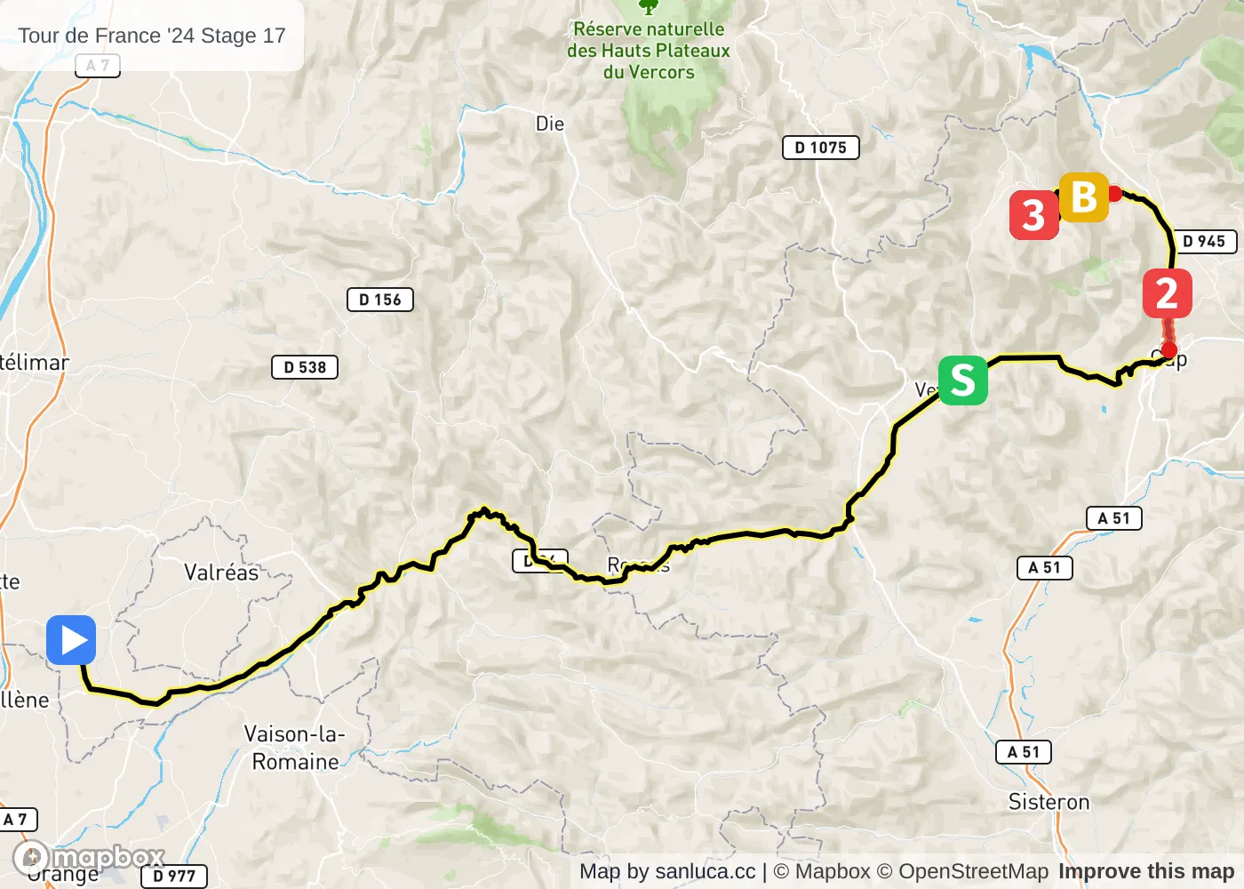
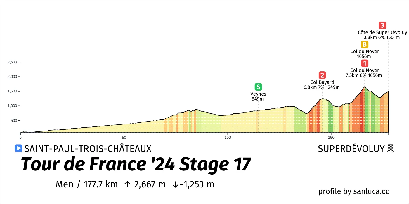
- Total distance: 177.7 km
- Type: Medium Mountain
- Ascent: 2666.5 m
- Descent: -1253.2 m
- Date: Jul 17
- Start time: 10:45
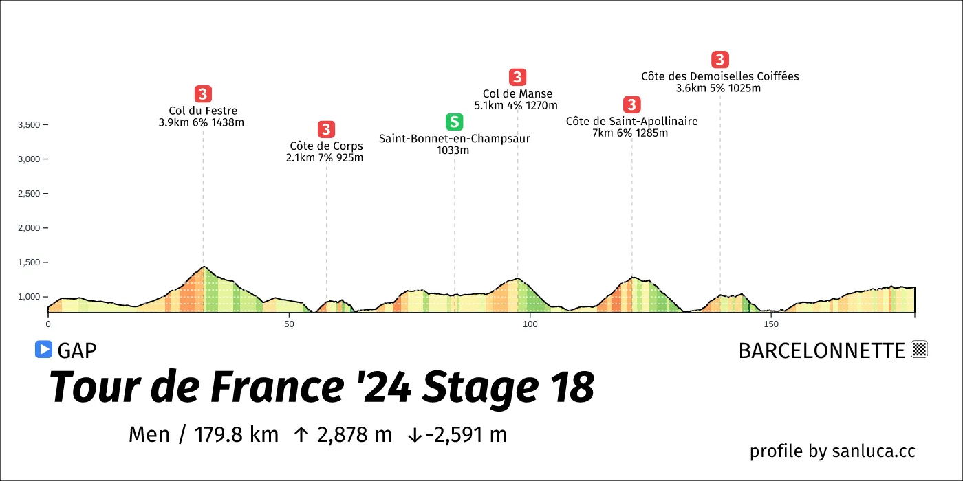
- Total distance: 179.8 km
- Type: Medium Mountain
- Ascent: 2878.1 m
- Descent: -2591.1 m
- Date: Jul 18
- Start time: 11:20
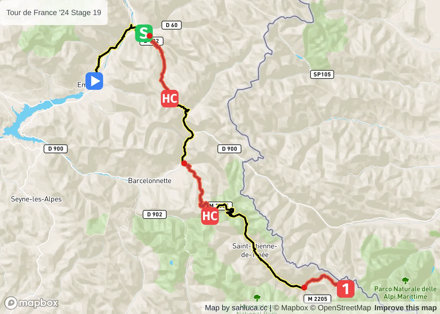
- Total distance: 145 km
- Type: Mountain
- Ascent: 4341.4 m
- Descent: -3210.3 m
- Date: Jul 19
- Start time: 10:30
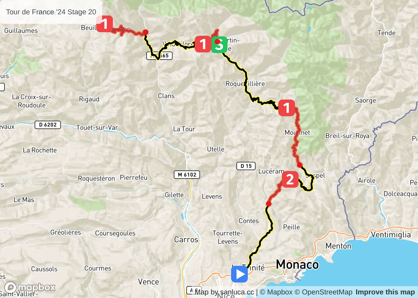
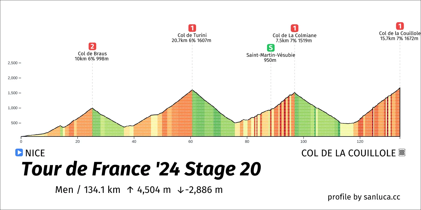
- Total distance: 134.1 km
- Type: Mountain
- Ascent: 4504.4 m
- Descent: -2886 m
- Date: Jul 20
- Start time: 11:55
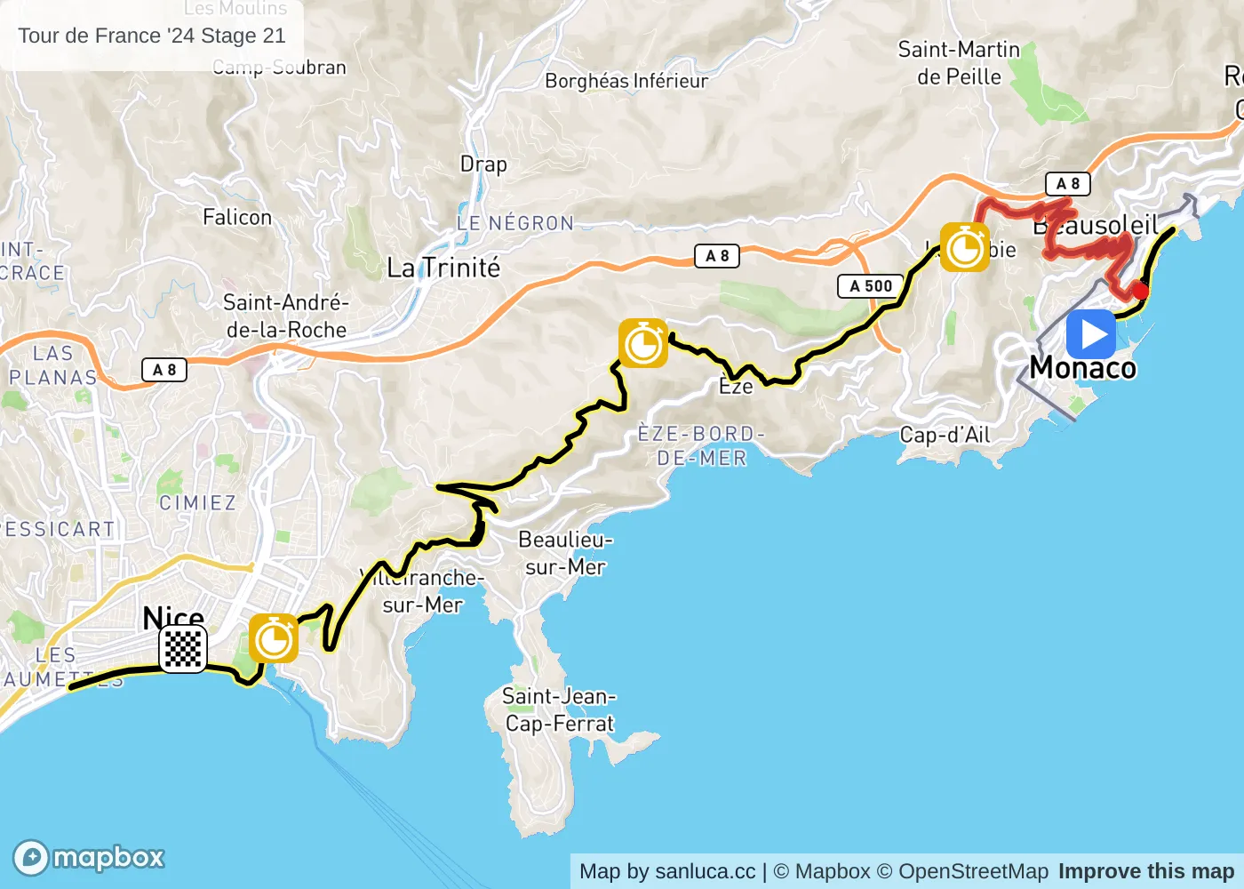
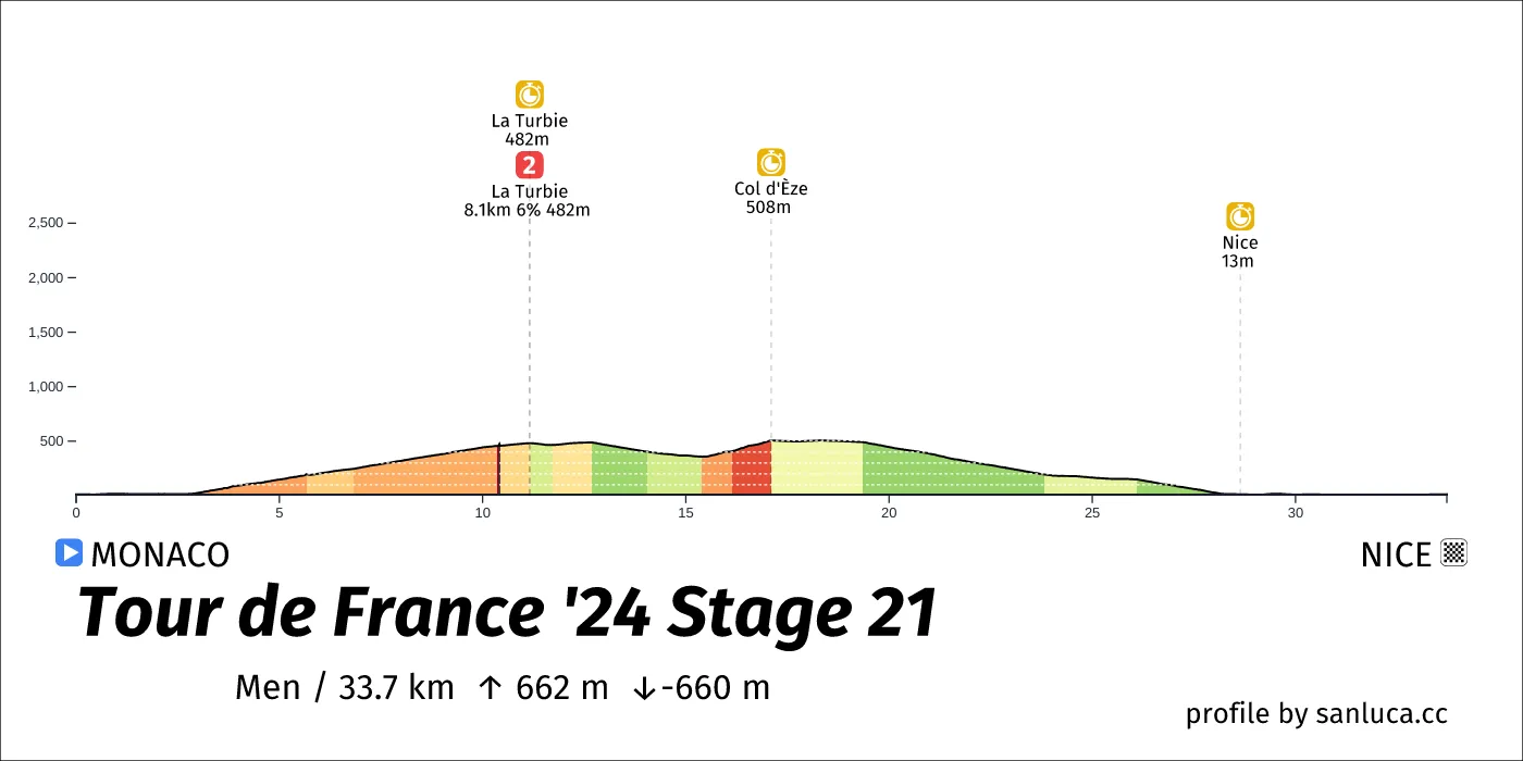
- Total distance: 33.7 km
- Type: Hilly
- Ascent: 661.5 m
- Descent: -659.8 m
- Date: Jul 21
- Start time: 12:40
