Sunday 14 January 2024 at 00:56
Santos Tour Down Under '24 / Stage 3
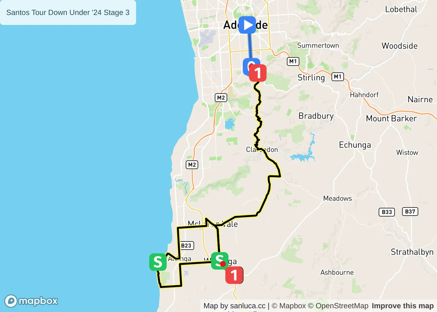
Adelaide - Willunga Hill
Classification: 2.WWT - Category WE
The stage
Stage 3 of the 2024 Santos Tour Down Under is a hilly stage that will take place on Sunday 14 January 2024 at 00:56.The stage starts in Adelaide and finishes in Willunga Hill. Start time is 00:56 with an expected finish at 03:31 (average speed of 36 km/h).
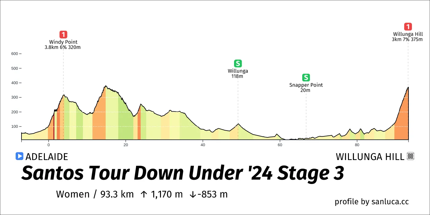
The total distance of the stage is 93.3 km. The stage includes 2 categorized climbs and 2 intermediate sprints. The stage has a total elevation gain of 1170 m with the highest altitude of the stage being 385 m. The total descent of the stage is -853 m.
Weather and forecast
- The race will have temperatures between 20 and 24°C, with an average of 21°C.
- No rain is expected.
- The wind will come mainly from E, SE with an average of 26 km/h wind. The maximum wind speed will be 35 km/h with gusts of up to 68 km/h.
Points of interest
The stage includes 2 categorized climbs and 2 intermediate sprints.
Windy Point
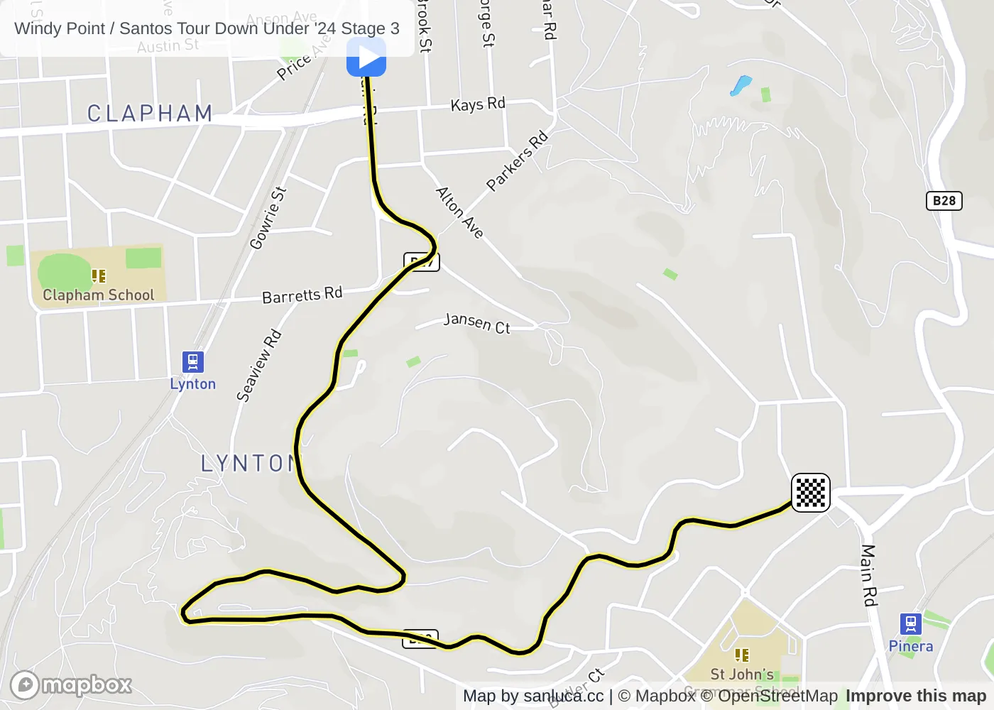
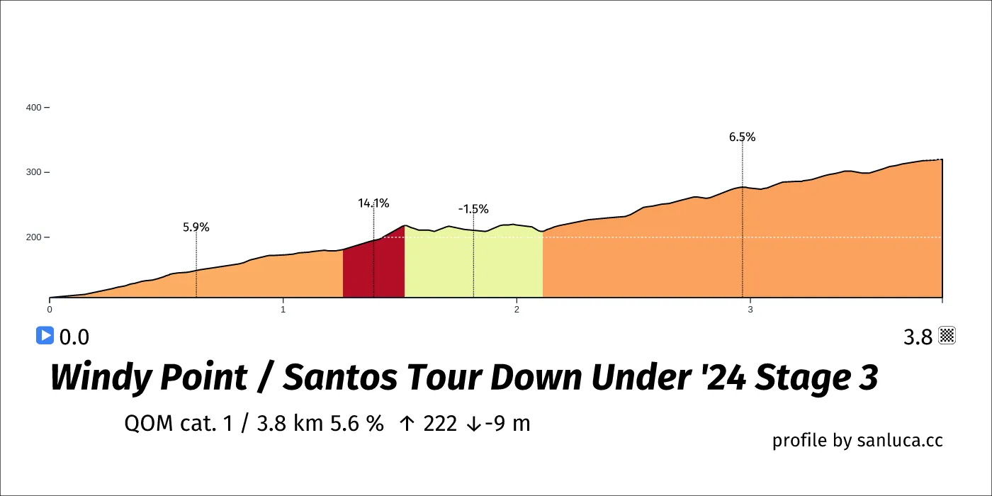
Windy Point is a QOM cat. 1 climb, which starts at 0 km (93.3 km to go) and ends at 3.8 km (89.5 km to go). It has total distance of 3.8 km, and an average gradient of 5.6%, going from 107 to 320 meters of altitude.
Neutral start
The neutral start for this stage is 7 km long with an average gradient of 0.7%.
Willunga
Willunga is a Sprint at 49.1 km (44.2 km to go).
Snapper Point
Snapper Point is a Sprint at 66.8 km (26.6 km to go).
Willunga Hill
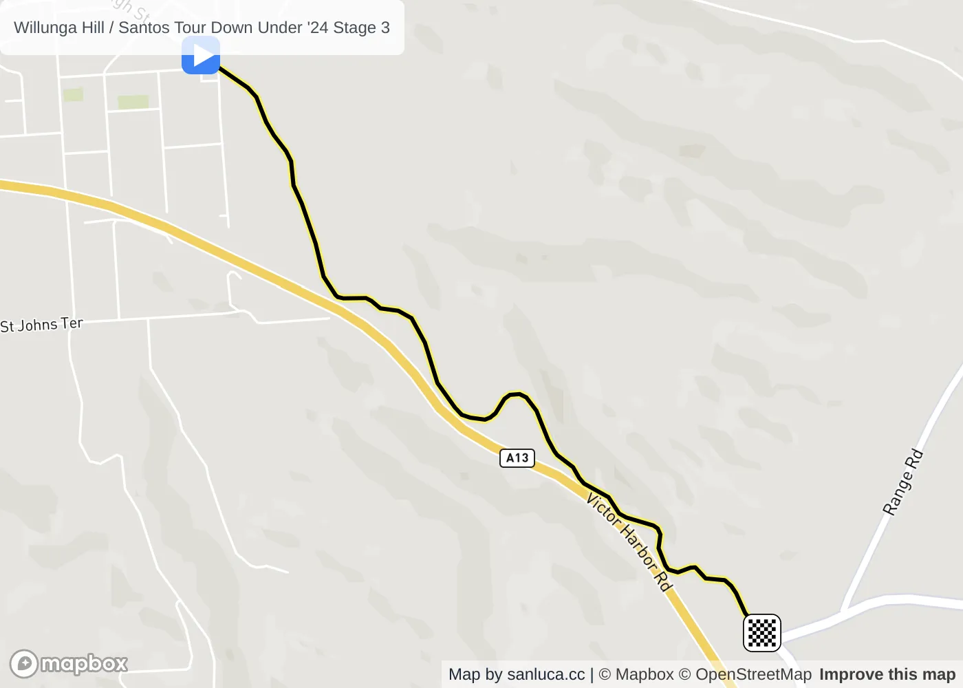
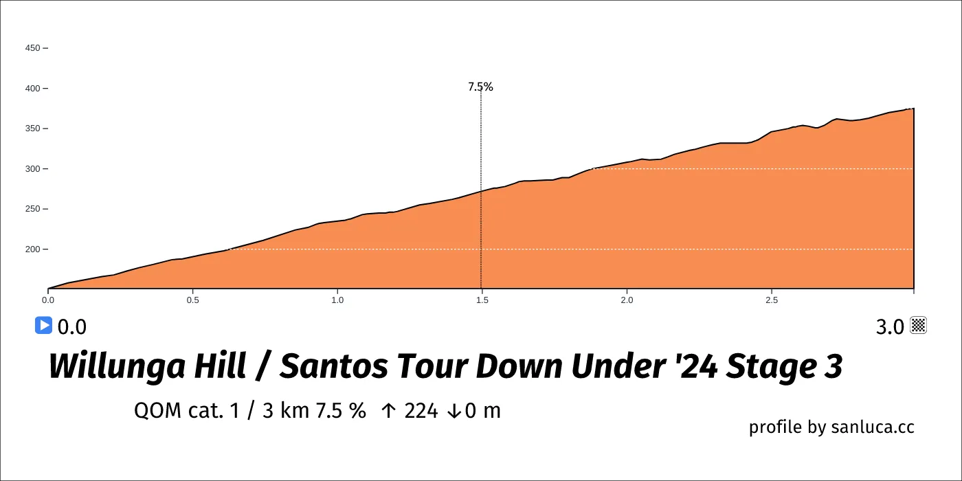
Willunga Hill is a QOM cat. 1 climb, which starts at 90.2 km (3.1 km to go) and ends at 93.2 km (0.1 km to go). It has total distance of 3 km, and an average gradient of 7.5%, going from 151 to 375 meters of altitude.
Final 3k
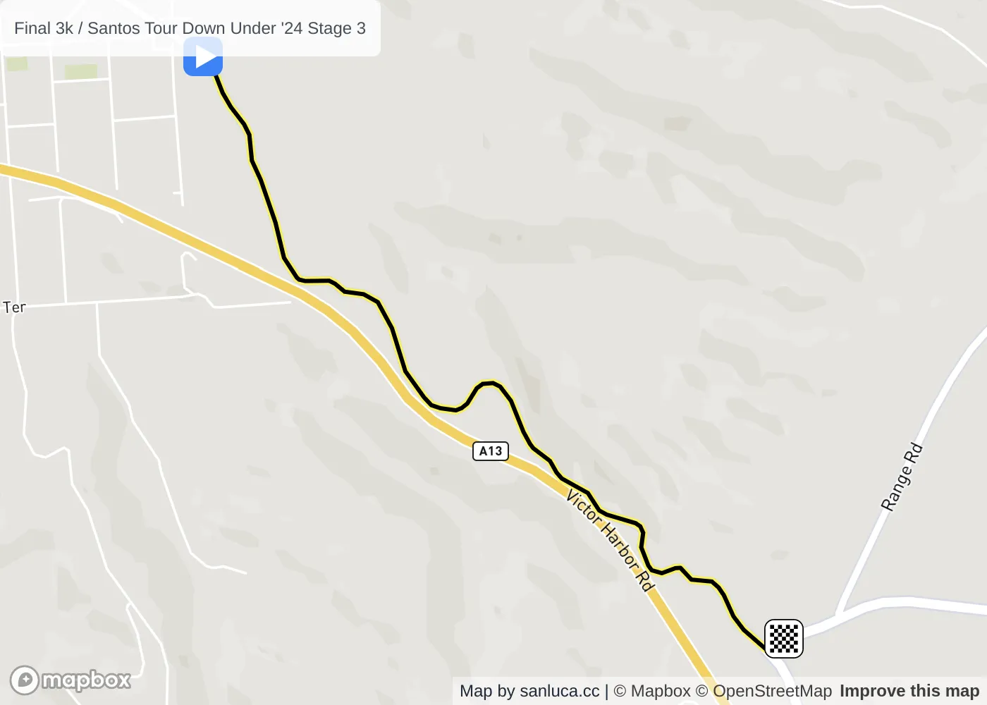
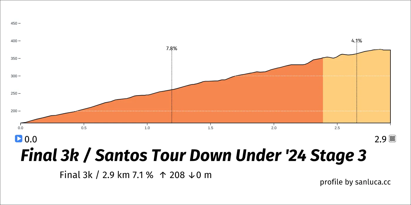
The final 3 km for this stage starts at 90.4 km, has an average gradient of 7.1%, and reaching 374 m of altitude.
