Thursday 26 September 2024 at 08:02
UCI Cycling World Championships - Road '24 / Women Junior Road Race
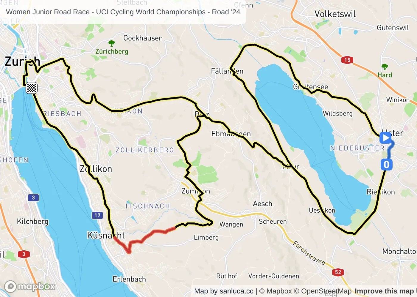
Uster - Zurich
Classification: CM - Category CM
← go to Team Time Trial Mixed Relay - Interactive map 🗺️- go to Men Junior Road Race →
The race
The Women Junior Road Race of the 2024 UCI Cycling World Championships - Road is a lumpy race that will take place on Thursday 26 September 2024 at 08:02.The race starts in Uster and finishes in Zurich. Start time is 08:02 with an expected finish at 10:01 (average speed of 37 km/h).
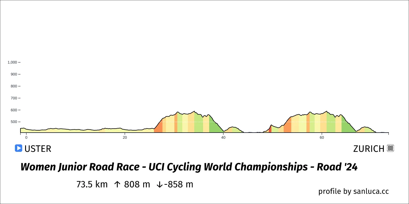
The total distance of the race is 73.5 km. The race includes 2 categorized climbs and 0 intermediate sprints. The race has a total elevation gain of 807.6 m with the highest altitude of the race being 674 m. The total descent of the race is -857.7 m.
Weather and forecast
- The race will have temperatures between 14 and 16°C, with an average of 15°C.
- 4 mm of rain expected at some point in the race
- The wind will come mainly from N, NW, SW, S, W with an average of 2 km/h wind. The maximum wind speed will be 4 km/h with gusts of up to 27 km/h.
Points of interest
The race includes 2 categorized climbs and 0 intermediate sprints.
Neutral start
The neutral start for this race is 1.2 km long with an average gradient of -0.8%.
Descent
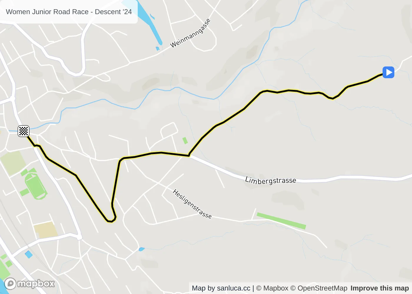
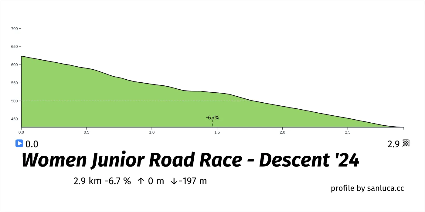
Descent is a Descent climb, which starts at 37.2 km (36.4 km to go) and ends at 40.1 km (33.4 km to go). It has total distance of 0 km, and an average gradient of 0%, going from 624 to 428 meters of altitude.
Descent
Descent is a Descent climb, which starts at 64.1 km (9.5 km to go) and ends at 67 km (6.6 km to go). It has total distance of 0 km, and an average gradient of 0%, going from 624 to 428 meters of altitude.
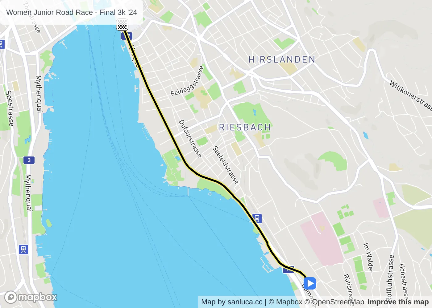
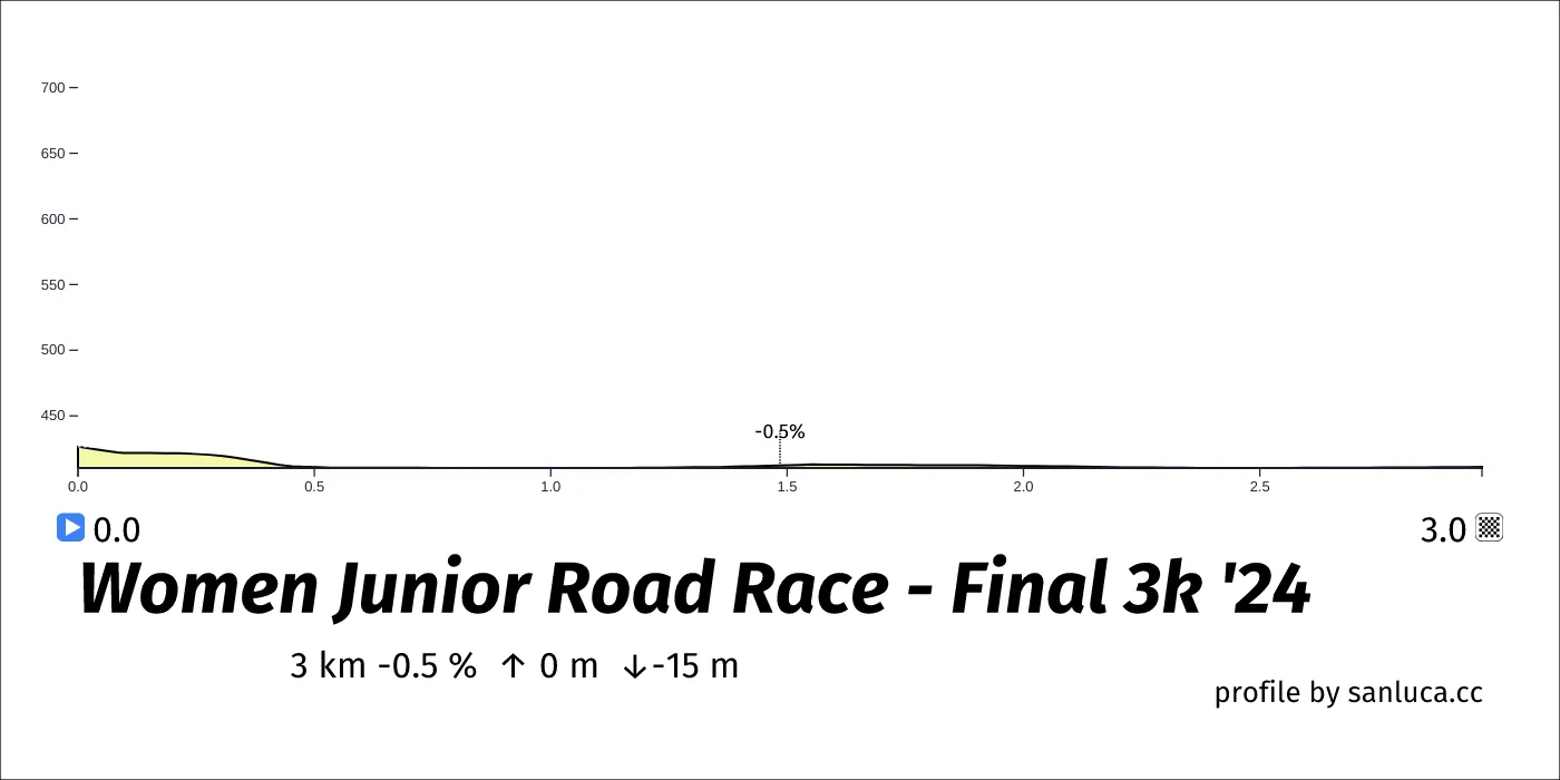
Final 3k
The final 3 km for this race starts at 70.6 km, has an average gradient of -0.5%, and reaching 411 m of altitude.
